You are here: Home > Network List > US - United States National Seismic Network Stations List
> Station ERPA Erie, Pennsylvania, USA > Earthquake Result Viewer
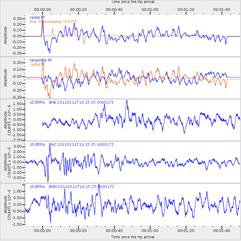
ERPA Erie, Pennsylvania, USA - Earthquake Result Viewer
*The percent match for this event was below the threshold and hence no stack was calculated.
| Earthquake location: |
Near East Coast Of Honshu, Japan |
| Earthquake latitude/longitude: |
39.3/142.9 |
| Earthquake time(UTC): |
2011/03/11 (070) 19:02:59 GMT |
| Earthquake Depth: |
27 km |
| Earthquake Magnitude: |
6.1 MB, 6.2 MS, 6.0 MW |
| Earthquake Catalog/Contributor: |
WHDF/NEIC |
|
| Network: |
US United States National Seismic Network |
| Station: |
ERPA Erie, Pennsylvania, USA |
| Lat/Lon: |
42.12 N/79.99 W |
| Elevation: |
306 m |
|
| Distance: |
90.1 deg |
| Az: |
30.404 deg |
| Baz: |
328.164 deg |
| Ray Param: |
$rayparam |
*The percent match for this event was below the threshold and hence was not used in the summary stack. |
|
| Radial Match: |
75.61534 % |
| Radial Bump: |
400 |
| Transverse Match: |
55.626347 % |
| Transverse Bump: |
400 |
| SOD ConfigId: |
356183 |
| Insert Time: |
2011-08-18 03:14:56.470 +0000 |
| GWidth: |
2.5 |
| Max Bumps: |
400 |
| Tol: |
0.001 |
|
Signal To Noise
| Channel | StoN | STA | LTA |
| US:ERPA: :BHZ:20110311T19:15:25.000017Z | 4.109105 | 1.5745704E-6 | 3.8319064E-7 |
| US:ERPA: :BHN:20110311T19:15:25.000017Z | 2.347107 | 6.0319303E-7 | 2.569943E-7 |
| US:ERPA: :BHE:20110311T19:15:25.000017Z | 3.604149 | 8.946739E-7 | 2.4823444E-7 |
| Arrivals |
| Ps | |
| PpPs | |
| PsPs/PpSs | |


