You are here: Home > Network List > TA - USArray Transportable Network (new EarthScope stations) Stations List
> Station 337A Centerville, TX, USA > Earthquake Result Viewer
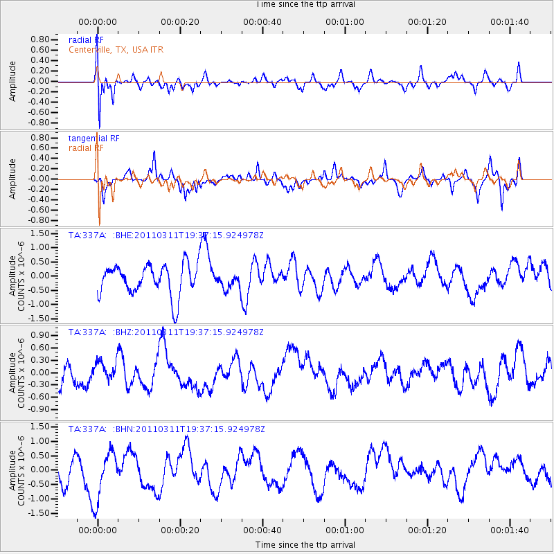
337A Centerville, TX, USA - Earthquake Result Viewer
*The percent match for this event was below the threshold and hence no stack was calculated.
| Earthquake location: |
Near East Coast Of Honshu, Japan |
| Earthquake latitude/longitude: |
35.7/140.7 |
| Earthquake time(UTC): |
2011/03/11 (070) 19:24:24 GMT |
| Earthquake Depth: |
2.2 km |
| Earthquake Magnitude: |
5.5 MB |
| Earthquake Catalog/Contributor: |
WHDF/NEIC |
|
| Network: |
TA USArray Transportable Network (new EarthScope stations) |
| Station: |
337A Centerville, TX, USA |
| Lat/Lon: |
31.32 N/95.89 W |
| Elevation: |
150 m |
|
| Distance: |
94.8 deg |
| Az: |
45.771 deg |
| Baz: |
317.032 deg |
| Ray Param: |
$rayparam |
*The percent match for this event was below the threshold and hence was not used in the summary stack. |
|
| Radial Match: |
42.89025 % |
| Radial Bump: |
400 |
| Transverse Match: |
55.104588 % |
| Transverse Bump: |
303 |
| SOD ConfigId: |
356183 |
| Insert Time: |
2011-08-18 06:04:08.671 +0000 |
| GWidth: |
2.5 |
| Max Bumps: |
400 |
| Tol: |
0.001 |
|
Signal To Noise
| Channel | StoN | STA | LTA |
| TA:337A: :BHZ:20110311T19:37:15.924978Z | 0.6265479 | 2.139958E-7 | 3.415474E-7 |
| TA:337A: :BHN:20110311T19:37:15.924978Z | 1.9265279 | 8.687979E-7 | 4.5096564E-7 |
| TA:337A: :BHE:20110311T19:37:15.924978Z | 0.5392279 | 2.918057E-7 | 5.4115463E-7 |
| Arrivals |
| Ps | |
| PpPs | |
| PsPs/PpSs | |


