You are here: Home > Network List > TA - USArray Transportable Network (new EarthScope stations) Stations List
> Station 136A Ennis, TX, USA > Earthquake Result Viewer
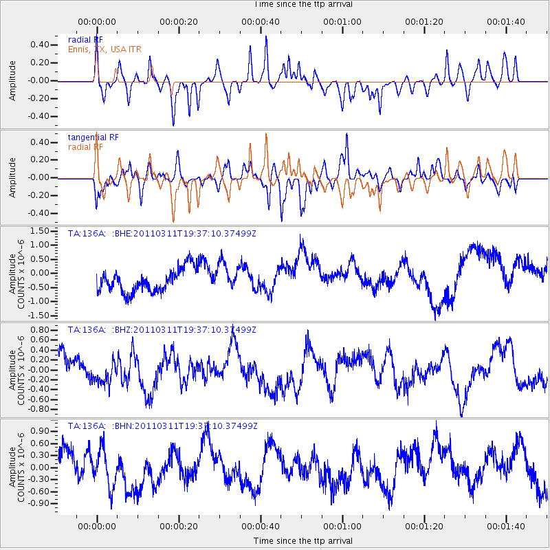
136A Ennis, TX, USA - Earthquake Result Viewer
*The percent match for this event was below the threshold and hence no stack was calculated.
| Earthquake location: |
Near East Coast Of Honshu, Japan |
| Earthquake latitude/longitude: |
35.7/140.7 |
| Earthquake time(UTC): |
2011/03/11 (070) 19:24:24 GMT |
| Earthquake Depth: |
2.2 km |
| Earthquake Magnitude: |
5.5 MB |
| Earthquake Catalog/Contributor: |
WHDF/NEIC |
|
| Network: |
TA USArray Transportable Network (new EarthScope stations) |
| Station: |
136A Ennis, TX, USA |
| Lat/Lon: |
32.47 N/96.53 W |
| Elevation: |
113 m |
|
| Distance: |
93.6 deg |
| Az: |
45.381 deg |
| Baz: |
316.722 deg |
| Ray Param: |
$rayparam |
*The percent match for this event was below the threshold and hence was not used in the summary stack. |
|
| Radial Match: |
60.019947 % |
| Radial Bump: |
346 |
| Transverse Match: |
41.634945 % |
| Transverse Bump: |
346 |
| SOD ConfigId: |
356183 |
| Insert Time: |
2011-08-18 06:11:13.886 +0000 |
| GWidth: |
2.5 |
| Max Bumps: |
400 |
| Tol: |
0.001 |
|
Signal To Noise
| Channel | StoN | STA | LTA |
| TA:136A: :BHZ:20110311T19:37:10.37499Z | 0.9275083 | 2.7229208E-7 | 2.9357375E-7 |
| TA:136A: :BHN:20110311T19:37:10.37499Z | 1.3053339 | 5.05161E-7 | 3.8699756E-7 |
| TA:136A: :BHE:20110311T19:37:10.37499Z | 1.2416658 | 5.07371E-7 | 4.0862122E-7 |
| Arrivals |
| Ps | |
| PpPs | |
| PsPs/PpSs | |


