You are here: Home > Network List > TA - USArray Transportable Network (new EarthScope stations) Stations List
> Station K31A O'Neill, NE, USA > Earthquake Result Viewer
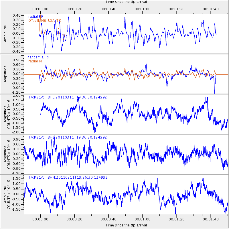
K31A O'Neill, NE, USA - Earthquake Result Viewer
*The percent match for this event was below the threshold and hence no stack was calculated.
| Earthquake location: |
Near East Coast Of Honshu, Japan |
| Earthquake latitude/longitude: |
35.7/140.7 |
| Earthquake time(UTC): |
2011/03/11 (070) 19:24:24 GMT |
| Earthquake Depth: |
2.2 km |
| Earthquake Magnitude: |
5.5 MB |
| Earthquake Catalog/Contributor: |
WHDF/NEIC |
|
| Network: |
TA USArray Transportable Network (new EarthScope stations) |
| Station: |
K31A O'Neill, NE, USA |
| Lat/Lon: |
42.62 N/98.75 W |
| Elevation: |
580 m |
|
| Distance: |
85.1 deg |
| Az: |
39.624 deg |
| Baz: |
315.298 deg |
| Ray Param: |
$rayparam |
*The percent match for this event was below the threshold and hence was not used in the summary stack. |
|
| Radial Match: |
50.780594 % |
| Radial Bump: |
400 |
| Transverse Match: |
48.073387 % |
| Transverse Bump: |
400 |
| SOD ConfigId: |
356183 |
| Insert Time: |
2011-08-18 06:16:43.521 +0000 |
| GWidth: |
2.5 |
| Max Bumps: |
400 |
| Tol: |
0.001 |
|
Signal To Noise
| Channel | StoN | STA | LTA |
| TA:K31A: :BHZ:20110311T19:36:30.12499Z | 1.0637743 | 3.3588918E-7 | 3.1575232E-7 |
| TA:K31A: :BHN:20110311T19:36:30.12499Z | 1.4193358 | 5.736345E-7 | 4.04157E-7 |
| TA:K31A: :BHE:20110311T19:36:30.12499Z | 2.142298 | 1.3435504E-6 | 6.2715384E-7 |
| Arrivals |
| Ps | |
| PpPs | |
| PsPs/PpSs | |


