You are here: Home > Network List > TA - USArray Transportable Network (new EarthScope stations) Stations List
> Station P37A Lathrop, MO, USA > Earthquake Result Viewer
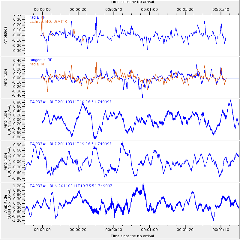
P37A Lathrop, MO, USA - Earthquake Result Viewer
*The percent match for this event was below the threshold and hence no stack was calculated.
| Earthquake location: |
Near East Coast Of Honshu, Japan |
| Earthquake latitude/longitude: |
35.7/140.7 |
| Earthquake time(UTC): |
2011/03/11 (070) 19:24:24 GMT |
| Earthquake Depth: |
2.2 km |
| Earthquake Magnitude: |
5.5 MB |
| Earthquake Catalog/Contributor: |
WHDF/NEIC |
|
| Network: |
TA USArray Transportable Network (new EarthScope stations) |
| Station: |
P37A Lathrop, MO, USA |
| Lat/Lon: |
39.59 N/94.35 W |
| Elevation: |
300 m |
|
| Distance: |
89.6 deg |
| Az: |
39.277 deg |
| Baz: |
318.169 deg |
| Ray Param: |
$rayparam |
*The percent match for this event was below the threshold and hence was not used in the summary stack. |
|
| Radial Match: |
54.25848 % |
| Radial Bump: |
318 |
| Transverse Match: |
68.37984 % |
| Transverse Bump: |
400 |
| SOD ConfigId: |
356183 |
| Insert Time: |
2011-08-18 06:23:10.282 +0000 |
| GWidth: |
2.5 |
| Max Bumps: |
400 |
| Tol: |
0.001 |
|
Signal To Noise
| Channel | StoN | STA | LTA |
| TA:P37A: :BHZ:20110311T19:36:51.74999Z | 2.3678057 | 5.220081E-7 | 2.204607E-7 |
| TA:P37A: :BHN:20110311T19:36:51.74999Z | 0.49704453 | 2.412311E-7 | 4.85331E-7 |
| TA:P37A: :BHE:20110311T19:36:51.74999Z | 1.5916862 | 5.655607E-7 | 3.553217E-7 |
| Arrivals |
| Ps | |
| PpPs | |
| PsPs/PpSs | |


