You are here: Home > Network List > TA - USArray Transportable Network (new EarthScope stations) Stations List
> Station 243A Waterproof, LA, USA > Earthquake Result Viewer
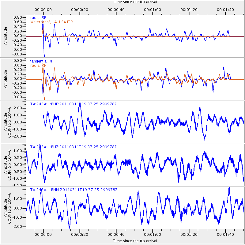
243A Waterproof, LA, USA - Earthquake Result Viewer
*The percent match for this event was below the threshold and hence no stack was calculated.
| Earthquake location: |
Near East Coast Of Honshu, Japan |
| Earthquake latitude/longitude: |
35.7/140.7 |
| Earthquake time(UTC): |
2011/03/11 (070) 19:24:24 GMT |
| Earthquake Depth: |
2.2 km |
| Earthquake Magnitude: |
5.5 MB |
| Earthquake Catalog/Contributor: |
WHDF/NEIC |
|
| Network: |
TA USArray Transportable Network (new EarthScope stations) |
| Station: |
243A Waterproof, LA, USA |
| Lat/Lon: |
31.88 N/91.48 W |
| Elevation: |
2.0 m |
|
| Distance: |
96.9 deg |
| Az: |
42.575 deg |
| Baz: |
319.654 deg |
| Ray Param: |
$rayparam |
*The percent match for this event was below the threshold and hence was not used in the summary stack. |
|
| Radial Match: |
54.409237 % |
| Radial Bump: |
400 |
| Transverse Match: |
45.00917 % |
| Transverse Bump: |
348 |
| SOD ConfigId: |
356183 |
| Insert Time: |
2011-08-18 06:27:30.279 +0000 |
| GWidth: |
2.5 |
| Max Bumps: |
400 |
| Tol: |
0.001 |
|
Signal To Noise
| Channel | StoN | STA | LTA |
| TA:243A: :BHZ:20110311T19:37:25.299978Z | 1.3991085 | 6.786324E-7 | 4.850463E-7 |
| TA:243A: :BHN:20110311T19:37:25.299978Z | 0.8338267 | 6.854675E-7 | 8.2207424E-7 |
| TA:243A: :BHE:20110311T19:37:25.299978Z | 0.88275254 | 8.769392E-7 | 9.934146E-7 |
| Arrivals |
| Ps | |
| PpPs | |
| PsPs/PpSs | |


