You are here: Home > Network List > CI - Caltech Regional Seismic Network Stations List
> Station BAR Barrett, Tecate, CA, USA > Earthquake Result Viewer
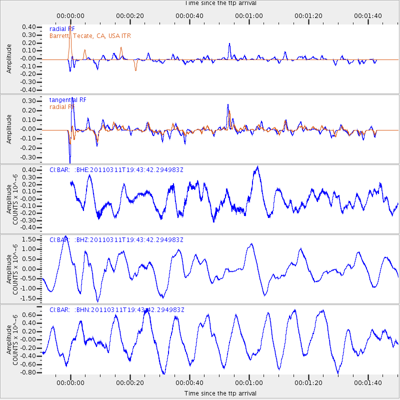
BAR Barrett, Tecate, CA, USA - Earthquake Result Viewer
*The percent match for this event was below the threshold and hence no stack was calculated.
| Earthquake location: |
Eastern Honshu, Japan |
| Earthquake latitude/longitude: |
36.9/138.3 |
| Earthquake time(UTC): |
2011/03/11 (070) 19:31:56 GMT |
| Earthquake Depth: |
12 km |
| Earthquake Magnitude: |
5.5 MB, 5.7 MS |
| Earthquake Catalog/Contributor: |
WHDF/NEIC |
|
| Network: |
CI Caltech Regional Seismic Network |
| Station: |
BAR Barrett, Tecate, CA, USA |
| Lat/Lon: |
32.68 N/116.67 W |
| Elevation: |
521 m |
|
| Distance: |
81.6 deg |
| Az: |
55.424 deg |
| Baz: |
308.538 deg |
| Ray Param: |
$rayparam |
*The percent match for this event was below the threshold and hence was not used in the summary stack. |
|
| Radial Match: |
58.81715 % |
| Radial Bump: |
398 |
| Transverse Match: |
54.64931 % |
| Transverse Bump: |
400 |
| SOD ConfigId: |
356183 |
| Insert Time: |
2011-08-18 07:01:14.972 +0000 |
| GWidth: |
2.5 |
| Max Bumps: |
400 |
| Tol: |
0.001 |
|
Signal To Noise
| Channel | StoN | STA | LTA |
| CI:BAR: :BHZ:20110311T19:43:42.294983Z | 1.3713094 | 8.1696476E-7 | 5.9575524E-7 |
| CI:BAR: :BHN:20110311T19:43:42.294983Z | 1.0152843 | 2.908781E-7 | 2.8649916E-7 |
| CI:BAR: :BHE:20110311T19:43:42.294983Z | 1.161214 | 1.681647E-7 | 1.44818E-7 |
| Arrivals |
| Ps | |
| PpPs | |
| PsPs/PpSs | |


