You are here: Home > Network List > TA - USArray Transportable Network (new EarthScope stations) Stations List
> Station R36A Gordon, Harris, KS, USA > Earthquake Result Viewer
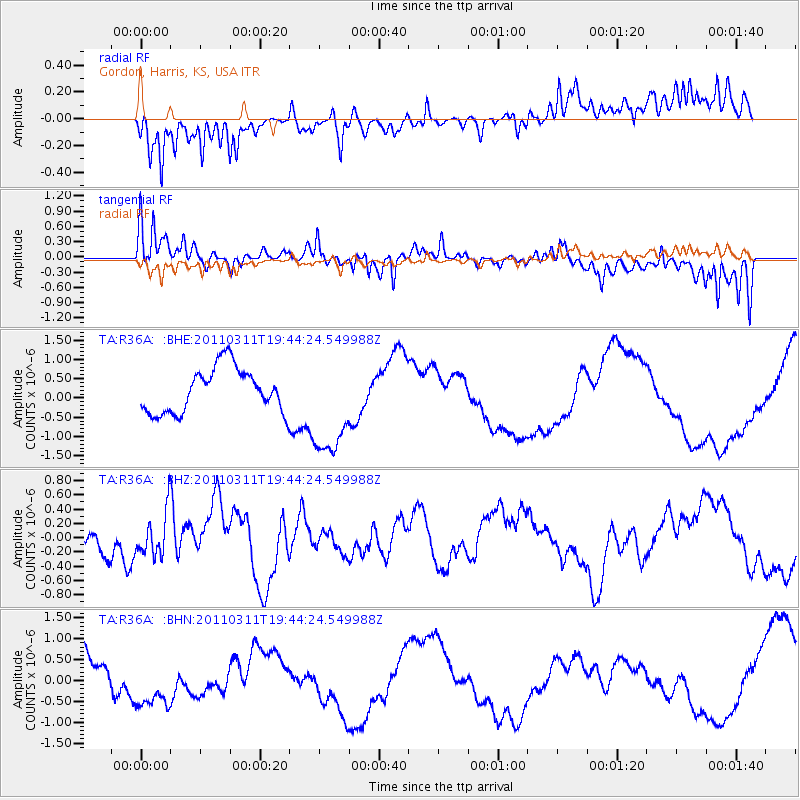
R36A Gordon, Harris, KS, USA - Earthquake Result Viewer
*The percent match for this event was below the threshold and hence no stack was calculated.
| Earthquake location: |
Eastern Honshu, Japan |
| Earthquake latitude/longitude: |
36.9/138.3 |
| Earthquake time(UTC): |
2011/03/11 (070) 19:31:56 GMT |
| Earthquake Depth: |
12 km |
| Earthquake Magnitude: |
5.5 MB, 5.7 MS |
| Earthquake Catalog/Contributor: |
WHDF/NEIC |
|
| Network: |
TA USArray Transportable Network (new EarthScope stations) |
| Station: |
R36A Gordon, Harris, KS, USA |
| Lat/Lon: |
38.32 N/95.50 W |
| Elevation: |
354 m |
|
| Distance: |
90.1 deg |
| Az: |
39.401 deg |
| Baz: |
319.718 deg |
| Ray Param: |
$rayparam |
*The percent match for this event was below the threshold and hence was not used in the summary stack. |
|
| Radial Match: |
57.50352 % |
| Radial Bump: |
400 |
| Transverse Match: |
59.820995 % |
| Transverse Bump: |
376 |
| SOD ConfigId: |
356183 |
| Insert Time: |
2011-08-18 07:49:21.597 +0000 |
| GWidth: |
2.5 |
| Max Bumps: |
400 |
| Tol: |
0.001 |
|
Signal To Noise
| Channel | StoN | STA | LTA |
| TA:R36A: :BHZ:20110311T19:44:24.549988Z | 1.5090741 | 3.052857E-7 | 2.0230001E-7 |
| TA:R36A: :BHN:20110311T19:44:24.549988Z | 1.4182477 | 5.976284E-7 | 4.213851E-7 |
| TA:R36A: :BHE:20110311T19:44:24.549988Z | 2.3685389 | 1.3661319E-6 | 5.7678255E-7 |
| Arrivals |
| Ps | |
| PpPs | |
| PsPs/PpSs | |


