You are here: Home > Network List > TA - USArray Transportable Network (new EarthScope stations) Stations List
> Station Z41A Richland Creek Farm, El Dorado, AR, USA > Earthquake Result Viewer
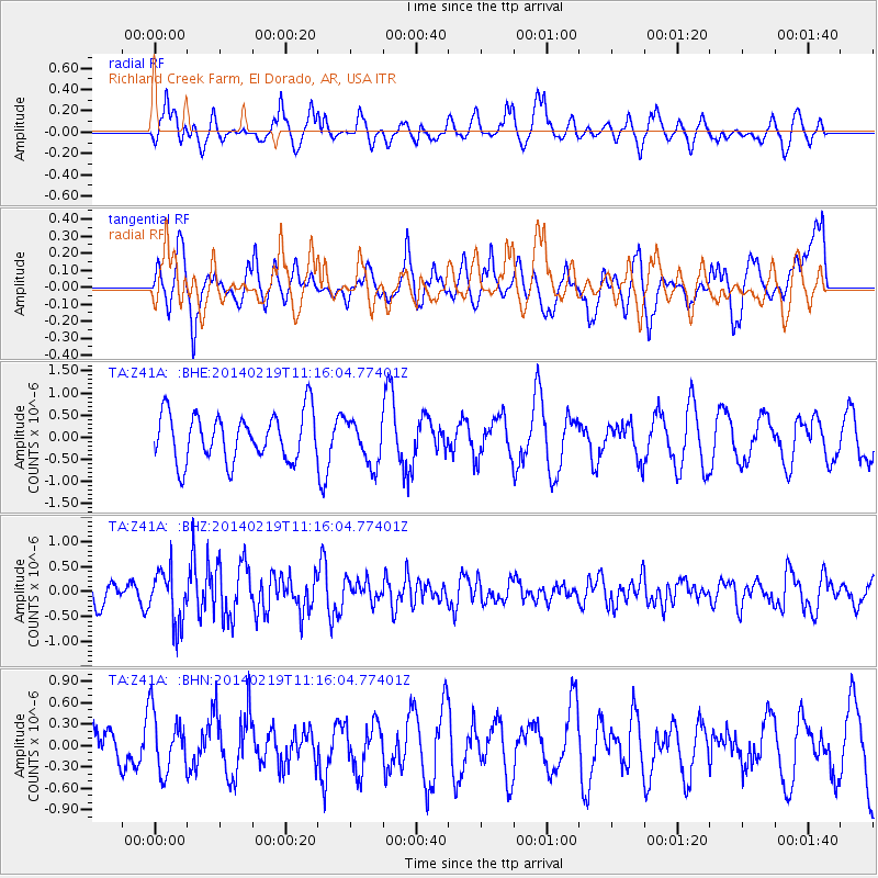
Z41A Richland Creek Farm, El Dorado, AR, USA - Earthquake Result Viewer
*The percent match for this event was below the threshold and hence no stack was calculated.
| Earthquake location: |
Venezuela |
| Earthquake latitude/longitude: |
9.7/-69.8 |
| Earthquake time(UTC): |
2014/02/19 (050) 11:10:13 GMT |
| Earthquake Depth: |
20 km |
| Earthquake Magnitude: |
5.3 MW |
| Earthquake Catalog/Contributor: |
ISC/ISC |
|
| Network: |
TA USArray Transportable Network (new EarthScope stations) |
| Station: |
Z41A Richland Creek Farm, El Dorado, AR, USA |
| Lat/Lon: |
33.26 N/92.80 W |
| Elevation: |
62 m |
|
| Distance: |
31.6 deg |
| Az: |
321.298 deg |
| Baz: |
132.628 deg |
| Ray Param: |
$rayparam |
*The percent match for this event was below the threshold and hence was not used in the summary stack. |
|
| Radial Match: |
54.14018 % |
| Radial Bump: |
362 |
| Transverse Match: |
55.584095 % |
| Transverse Bump: |
380 |
| SOD ConfigId: |
3390531 |
| Insert Time: |
2019-04-10 09:34:14.981 +0000 |
| GWidth: |
2.5 |
| Max Bumps: |
400 |
| Tol: |
0.001 |
|
Signal To Noise
| Channel | StoN | STA | LTA |
| TA:Z41A: :BHZ:20140219T11:16:04.77401Z | 2.14167 | 5.380193E-7 | 2.5121489E-7 |
| TA:Z41A: :BHN:20140219T11:16:04.77401Z | 1.0131086 | 4.254797E-7 | 4.199744E-7 |
| TA:Z41A: :BHE:20140219T11:16:04.77401Z | 0.9388413 | 5.033995E-7 | 5.361924E-7 |
| Arrivals |
| Ps | |
| PpPs | |
| PsPs/PpSs | |


