You are here: Home > Network List > TA - USArray Transportable Network (new EarthScope stations) Stations List
> Station O56A Blue Knob State Park, Imler, PA, USA > Earthquake Result Viewer
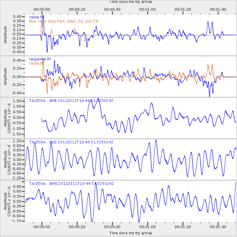
O56A Blue Knob State Park, Imler, PA, USA - Earthquake Result Viewer
*The percent match for this event was below the threshold and hence no stack was calculated.
| Earthquake location: |
Eastern Honshu, Japan |
| Earthquake latitude/longitude: |
36.9/138.3 |
| Earthquake time(UTC): |
2011/03/11 (070) 19:31:56 GMT |
| Earthquake Depth: |
12 km |
| Earthquake Magnitude: |
5.5 MB, 5.7 MS |
| Earthquake Catalog/Contributor: |
WHDF/NEIC |
|
| Network: |
TA USArray Transportable Network (new EarthScope stations) |
| Station: |
O56A Blue Knob State Park, Imler, PA, USA |
| Lat/Lon: |
40.27 N/78.57 W |
| Elevation: |
684 m |
|
| Distance: |
96.0 deg |
| Az: |
27.492 deg |
| Baz: |
331.096 deg |
| Ray Param: |
$rayparam |
*The percent match for this event was below the threshold and hence was not used in the summary stack. |
|
| Radial Match: |
57.469296 % |
| Radial Bump: |
378 |
| Transverse Match: |
37.36866 % |
| Transverse Bump: |
302 |
| SOD ConfigId: |
356183 |
| Insert Time: |
2011-08-18 08:08:38.222 +0000 |
| GWidth: |
2.5 |
| Max Bumps: |
400 |
| Tol: |
0.001 |
|
Signal To Noise
| Channel | StoN | STA | LTA |
| TA:O56A: :BHZ:20110311T19:44:51.525024Z | 0.65720654 | 4.5162938E-7 | 6.871955E-7 |
| TA:O56A: :BHN:20110311T19:44:51.525024Z | 0.7773148 | 3.5218926E-7 | 4.5308445E-7 |
| TA:O56A: :BHE:20110311T19:44:51.525024Z | 2.9137032 | 1.4255965E-6 | 4.892731E-7 |
| Arrivals |
| Ps | |
| PpPs | |
| PsPs/PpSs | |


