You are here: Home > Network List > US - United States National Seismic Network Stations List
> Station HAWA Hanford, Washington, USA > Earthquake Result Viewer
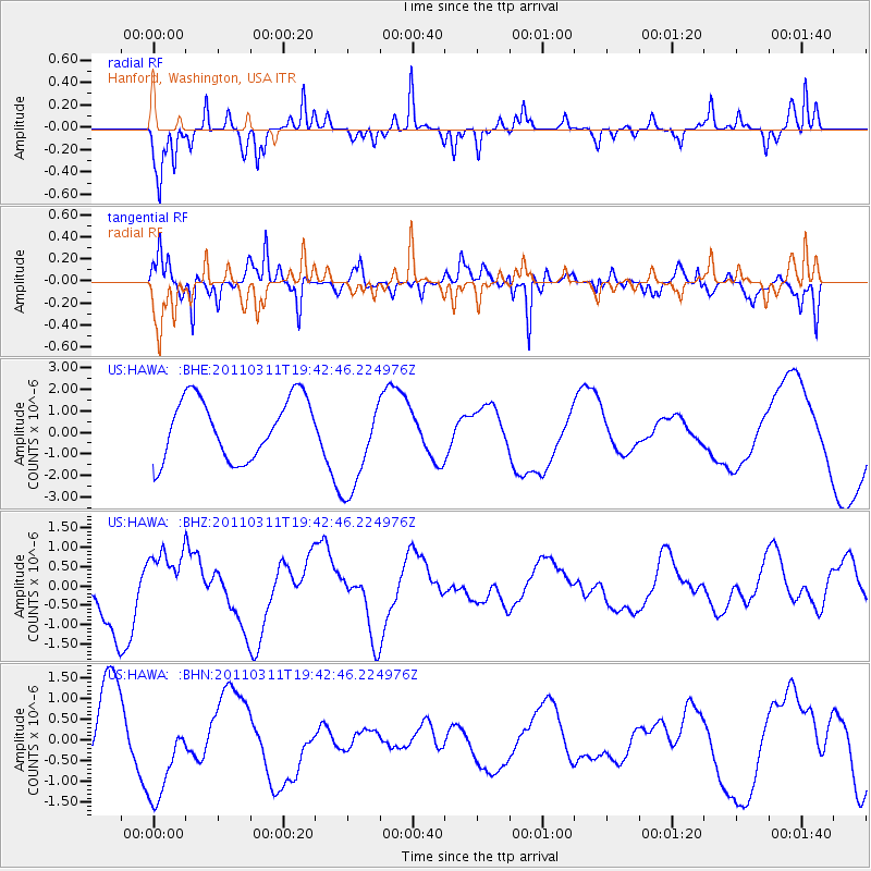
HAWA Hanford, Washington, USA - Earthquake Result Viewer
*The percent match for this event was below the threshold and hence no stack was calculated.
| Earthquake location: |
Eastern Honshu, Japan |
| Earthquake latitude/longitude: |
36.9/138.3 |
| Earthquake time(UTC): |
2011/03/11 (070) 19:31:56 GMT |
| Earthquake Depth: |
12 km |
| Earthquake Magnitude: |
5.5 MB, 5.7 MS |
| Earthquake Catalog/Contributor: |
WHDF/NEIC |
|
| Network: |
US United States National Seismic Network |
| Station: |
HAWA Hanford, Washington, USA |
| Lat/Lon: |
46.39 N/119.53 W |
| Elevation: |
364 m |
|
| Distance: |
71.6 deg |
| Az: |
45.471 deg |
| Baz: |
304.392 deg |
| Ray Param: |
$rayparam |
*The percent match for this event was below the threshold and hence was not used in the summary stack. |
|
| Radial Match: |
51.263504 % |
| Radial Bump: |
207 |
| Transverse Match: |
62.28707 % |
| Transverse Bump: |
286 |
| SOD ConfigId: |
356183 |
| Insert Time: |
2011-08-18 08:15:46.133 +0000 |
| GWidth: |
2.5 |
| Max Bumps: |
400 |
| Tol: |
0.001 |
|
Signal To Noise
| Channel | StoN | STA | LTA |
| US:HAWA: :BHZ:20110311T19:42:46.224976Z | 1.0196986 | 9.1870623E-7 | 9.009586E-7 |
| US:HAWA: :BHN:20110311T19:42:46.224976Z | 1.6385175 | 1.1050998E-6 | 6.744511E-7 |
| US:HAWA: :BHE:20110311T19:42:46.224976Z | 1.6538112 | 2.3130451E-6 | 1.3986149E-6 |
| Arrivals |
| Ps | |
| PpPs | |
| PsPs/PpSs | |


