You are here: Home > Network List > TA - USArray Transportable Network (new EarthScope stations) Stations List
> Station R29A Marienthal, KS, USA > Earthquake Result Viewer
R29A Marienthal, KS, USA - Earthquake Result Viewer

| Earthquake location: |
Near West Coast Of Honshu, Japan |
| Earthquake latitude/longitude: |
40.5/139.1 |
| Earthquake time(UTC): |
2011/03/11 (070) 19:46:50 GMT |
| Earthquake Depth: |
10 km |
| Earthquake Magnitude: |
6.2 MB, 6.1 MS, 6.2 MW |
| Earthquake Catalog/Contributor: |
WHDF/NEIC |
|
| Network: |
TA USArray Transportable Network (new EarthScope stations) |
| Station: |
R29A Marienthal, KS, USA |
| Lat/Lon: |
38.42 N/101.14 W |
| Elevation: |
957 m |
|
| Distance: |
84.1 deg |
| Az: |
43.248 deg |
| Baz: |
318.291 deg |
| Ray Param: |
0.04570587 |
| Estimated Moho Depth: |
51.0 km |
| Estimated Crust Vp/Vs: |
1.74 |
| Assumed Crust Vp: |
6.483 km/s |
| Estimated Crust Vs: |
3.736 km/s |
| Estimated Crust Poisson's Ratio: |
0.25 |
|
| Radial Match: |
95.42642 % |
| Radial Bump: |
391 |
| Transverse Match: |
87.45469 % |
| Transverse Bump: |
400 |
| SOD ConfigId: |
356183 |
| Insert Time: |
2011-08-18 09:07:56.917 +0000 |
| GWidth: |
2.5 |
| Max Bumps: |
400 |
| Tol: |
0.001 |
|
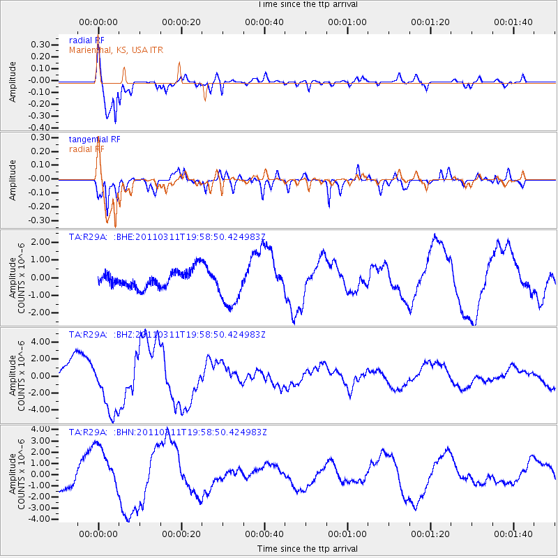
Signal To Noise
| Channel | StoN | STA | LTA |
| TA:R29A: :BHZ:20110311T19:58:50.424983Z | 2.447752 | 3.53541E-6 | 1.4443498E-6 |
| TA:R29A: :BHN:20110311T19:58:50.424983Z | 2.0532937 | 2.028914E-6 | 9.881265E-7 |
| TA:R29A: :BHE:20110311T19:58:50.424983Z | 2.6202328 | 1.2414749E-6 | 4.7380328E-7 |
| Arrivals |
| Ps | 5.9 SECOND |
| PpPs | 21 SECOND |
| PsPs/PpSs | 27 SECOND |


