You are here: Home > Network List > TA - USArray Transportable Network (new EarthScope stations) Stations List
> Station H26A Fairpoint, SD, USA > Earthquake Result Viewer
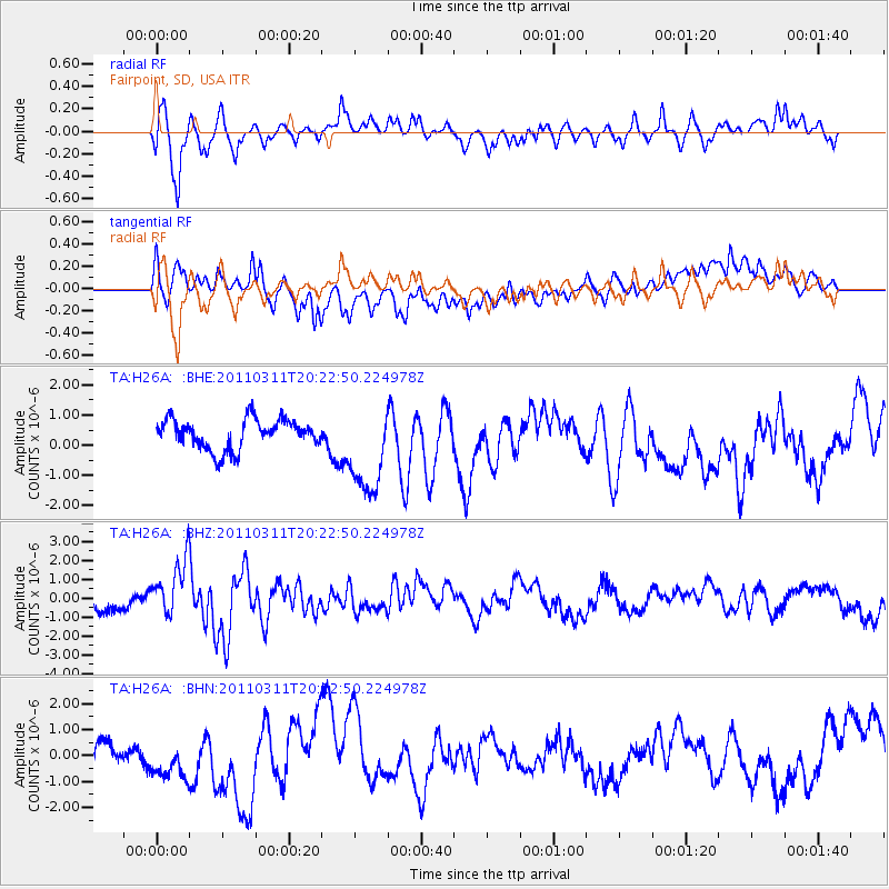
H26A Fairpoint, SD, USA - Earthquake Result Viewer
*The percent match for this event was below the threshold and hence no stack was calculated.
| Earthquake location: |
Near East Coast Of Honshu, Japan |
| Earthquake latitude/longitude: |
39.0/142.6 |
| Earthquake time(UTC): |
2011/03/11 (070) 20:11:24 GMT |
| Earthquake Depth: |
17 km |
| Earthquake Magnitude: |
5.9 MB, 5.8 MS, 6.1 MW |
| Earthquake Catalog/Contributor: |
WHDF/NEIC |
|
| Network: |
TA USArray Transportable Network (new EarthScope stations) |
| Station: |
H26A Fairpoint, SD, USA |
| Lat/Lon: |
44.62 N/102.77 W |
| Elevation: |
879 m |
|
| Distance: |
78.0 deg |
| Az: |
41.59 deg |
| Baz: |
313.599 deg |
| Ray Param: |
$rayparam |
*The percent match for this event was below the threshold and hence was not used in the summary stack. |
|
| Radial Match: |
77.597176 % |
| Radial Bump: |
400 |
| Transverse Match: |
50.297344 % |
| Transverse Bump: |
400 |
| SOD ConfigId: |
356183 |
| Insert Time: |
2011-08-18 11:26:24.948 +0000 |
| GWidth: |
2.5 |
| Max Bumps: |
400 |
| Tol: |
0.001 |
|
Signal To Noise
| Channel | StoN | STA | LTA |
| TA:H26A: :BHZ:20110311T20:22:50.224978Z | 3.4737418 | 1.4823262E-6 | 4.267232E-7 |
| TA:H26A: :BHN:20110311T20:22:50.224978Z | 1.4926028 | 9.297134E-7 | 6.2288063E-7 |
| TA:H26A: :BHE:20110311T20:22:50.224978Z | 3.1122699 | 1.5373353E-6 | 4.939595E-7 |
| Arrivals |
| Ps | |
| PpPs | |
| PsPs/PpSs | |


