You are here: Home > Network List > US - United States National Seismic Network Stations List
> Station AMTX Amarillo, Texas, USA > Earthquake Result Viewer
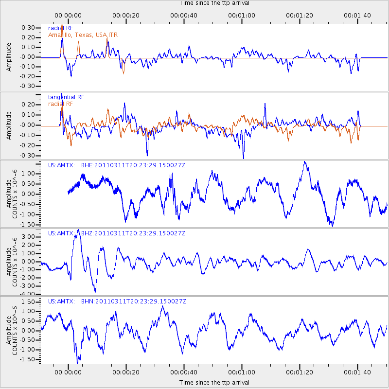
AMTX Amarillo, Texas, USA - Earthquake Result Viewer
*The percent match for this event was below the threshold and hence no stack was calculated.
| Earthquake location: |
Near East Coast Of Honshu, Japan |
| Earthquake latitude/longitude: |
39.0/142.6 |
| Earthquake time(UTC): |
2011/03/11 (070) 20:11:24 GMT |
| Earthquake Depth: |
17 km |
| Earthquake Magnitude: |
5.9 MB, 5.8 MS, 6.1 MW |
| Earthquake Catalog/Contributor: |
WHDF/NEIC |
|
| Network: |
US United States National Seismic Network |
| Station: |
AMTX Amarillo, Texas, USA |
| Lat/Lon: |
34.53 N/101.41 W |
| Elevation: |
1010 m |
|
| Distance: |
85.9 deg |
| Az: |
48.094 deg |
| Baz: |
315.382 deg |
| Ray Param: |
$rayparam |
*The percent match for this event was below the threshold and hence was not used in the summary stack. |
|
| Radial Match: |
60.798317 % |
| Radial Bump: |
400 |
| Transverse Match: |
69.00142 % |
| Transverse Bump: |
400 |
| SOD ConfigId: |
356183 |
| Insert Time: |
2011-08-18 12:45:35.556 +0000 |
| GWidth: |
2.5 |
| Max Bumps: |
400 |
| Tol: |
0.001 |
|
Signal To Noise
| Channel | StoN | STA | LTA |
| US:AMTX: :BHZ:20110311T20:23:29.150027Z | 3.3729076 | 2.3997964E-6 | 7.114919E-7 |
| US:AMTX: :BHN:20110311T20:23:29.150027Z | 1.2166908 | 8.384746E-7 | 6.891436E-7 |
| US:AMTX: :BHE:20110311T20:23:29.150027Z | 0.7981478 | 4.8606654E-7 | 6.0899316E-7 |
| Arrivals |
| Ps | |
| PpPs | |
| PsPs/PpSs | |


