You are here: Home > Network List > TA - USArray Transportable Network (new EarthScope stations) Stations List
> Station O48A Farmland, IN, USA > Earthquake Result Viewer
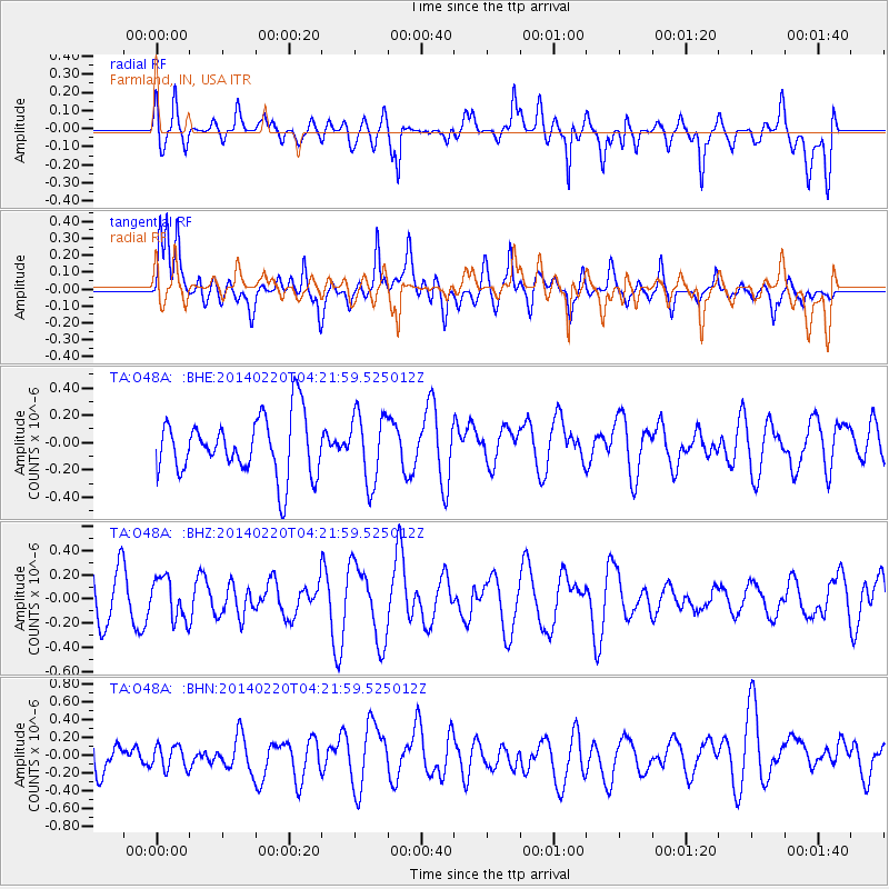
O48A Farmland, IN, USA - Earthquake Result Viewer
*The percent match for this event was below the threshold and hence no stack was calculated.
| Earthquake location: |
Southern Mid-Atlantic Ridge |
| Earthquake latitude/longitude: |
-14.1/-14.6 |
| Earthquake time(UTC): |
2014/02/20 (051) 04:09:57 GMT |
| Earthquake Depth: |
14 km |
| Earthquake Magnitude: |
5.1 MW |
| Earthquake Catalog/Contributor: |
ISC/ISC |
|
| Network: |
TA USArray Transportable Network (new EarthScope stations) |
| Station: |
O48A Farmland, IN, USA |
| Lat/Lon: |
40.26 N/85.16 W |
| Elevation: |
300 m |
|
| Distance: |
84.8 deg |
| Az: |
313.559 deg |
| Baz: |
113.282 deg |
| Ray Param: |
$rayparam |
*The percent match for this event was below the threshold and hence was not used in the summary stack. |
|
| Radial Match: |
52.883152 % |
| Radial Bump: |
400 |
| Transverse Match: |
57.97088 % |
| Transverse Bump: |
400 |
| SOD ConfigId: |
3390531 |
| Insert Time: |
2019-04-10 09:48:05.993 +0000 |
| GWidth: |
2.5 |
| Max Bumps: |
400 |
| Tol: |
0.001 |
|
Signal To Noise
| Channel | StoN | STA | LTA |
| TA:O48A: :BHZ:20140220T04:21:59.525012Z | 0.7641127 | 1.7250655E-7 | 2.257606E-7 |
| TA:O48A: :BHN:20140220T04:21:59.525012Z | 0.7927628 | 1.3739471E-7 | 1.7331125E-7 |
| TA:O48A: :BHE:20140220T04:21:59.525012Z | 1.1665864 | 2.5042405E-7 | 2.1466394E-7 |
| Arrivals |
| Ps | |
| PpPs | |
| PsPs/PpSs | |


