You are here: Home > Network List > UW - Pacific Northwest Regional Seismic Network Stations List
> Station LEBA Lebam, WA, USA > Earthquake Result Viewer
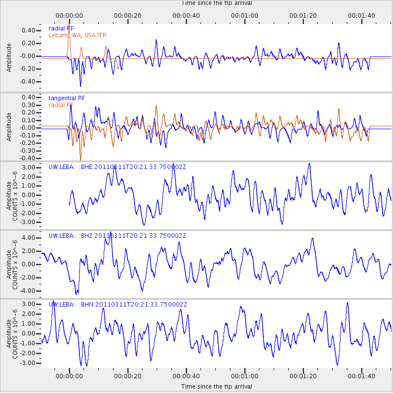
LEBA Lebam, WA, USA - Earthquake Result Viewer
*The percent match for this event was below the threshold and hence no stack was calculated.
| Earthquake location: |
Near East Coast Of Honshu, Japan |
| Earthquake latitude/longitude: |
39.0/142.6 |
| Earthquake time(UTC): |
2011/03/11 (070) 20:11:24 GMT |
| Earthquake Depth: |
17 km |
| Earthquake Magnitude: |
5.9 MB, 5.8 MS, 6.1 MW |
| Earthquake Catalog/Contributor: |
WHDF/NEIC |
|
| Network: |
UW Pacific Northwest Regional Seismic Network |
| Station: |
LEBA Lebam, WA, USA |
| Lat/Lon: |
46.55 N/123.56 W |
| Elevation: |
73 m |
|
| Distance: |
65.3 deg |
| Az: |
49.293 deg |
| Baz: |
301.158 deg |
| Ray Param: |
$rayparam |
*The percent match for this event was below the threshold and hence was not used in the summary stack. |
|
| Radial Match: |
67.22825 % |
| Radial Bump: |
400 |
| Transverse Match: |
61.020466 % |
| Transverse Bump: |
400 |
| SOD ConfigId: |
356183 |
| Insert Time: |
2011-08-18 12:49:46.814 +0000 |
| GWidth: |
2.5 |
| Max Bumps: |
400 |
| Tol: |
0.001 |
|
Signal To Noise
| Channel | StoN | STA | LTA |
| UW:LEBA: :BHZ:20110311T20:21:33.750002Z | 3.0290203 | 2.51902E-6 | 8.316286E-7 |
| UW:LEBA: :BHN:20110311T20:21:33.750002Z | 1.2939974 | 1.3137517E-6 | 1.015266E-6 |
| UW:LEBA: :BHE:20110311T20:21:33.750002Z | 1.0218941 | 1.3970041E-6 | 1.3670733E-6 |
| Arrivals |
| Ps | |
| PpPs | |
| PsPs/PpSs | |


