You are here: Home > Network List > TA - USArray Transportable Network (new EarthScope stations) Stations List
> Station L04D Klamath Falls, OR, USA > Earthquake Result Viewer
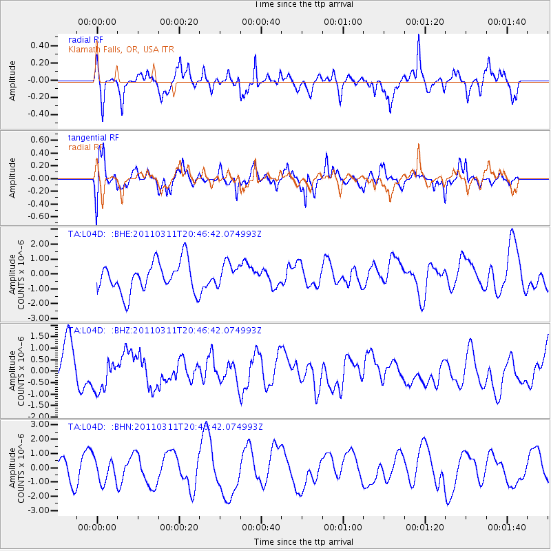
L04D Klamath Falls, OR, USA - Earthquake Result Viewer
*The percent match for this event was below the threshold and hence no stack was calculated.
| Earthquake location: |
Off East Coast Of Honshu, Japan |
| Earthquake latitude/longitude: |
37.8/142.8 |
| Earthquake time(UTC): |
2011/03/11 (070) 20:36:10 GMT |
| Earthquake Depth: |
26 km |
| Earthquake Magnitude: |
5.5 MB |
| Earthquake Catalog/Contributor: |
WHDF/NEIC |
|
| Network: |
TA USArray Transportable Network (new EarthScope stations) |
| Station: |
L04D Klamath Falls, OR, USA |
| Lat/Lon: |
42.22 N/122.30 W |
| Elevation: |
1437 m |
|
| Distance: |
69.0 deg |
| Az: |
52.468 deg |
| Baz: |
302.294 deg |
| Ray Param: |
$rayparam |
*The percent match for this event was below the threshold and hence was not used in the summary stack. |
|
| Radial Match: |
57.59881 % |
| Radial Bump: |
338 |
| Transverse Match: |
54.35814 % |
| Transverse Bump: |
400 |
| SOD ConfigId: |
356183 |
| Insert Time: |
2011-08-18 14:56:46.346 +0000 |
| GWidth: |
2.5 |
| Max Bumps: |
400 |
| Tol: |
0.001 |
|
Signal To Noise
| Channel | StoN | STA | LTA |
| TA:L04D: :BHZ:20110311T20:46:42.074993Z | 0.69823253 | 6.1542374E-7 | 8.8140223E-7 |
| TA:L04D: :BHN:20110311T20:46:42.074993Z | 0.8802962 | 8.630761E-7 | 9.804382E-7 |
| TA:L04D: :BHE:20110311T20:46:42.074993Z | 0.80792344 | 8.225811E-7 | 1.0181425E-6 |
| Arrivals |
| Ps | |
| PpPs | |
| PsPs/PpSs | |


