You are here: Home > Network List > TA - USArray Transportable Network (new EarthScope stations) Stations List
> Station C35A Jirik Farms, Max, MN, USA > Earthquake Result Viewer
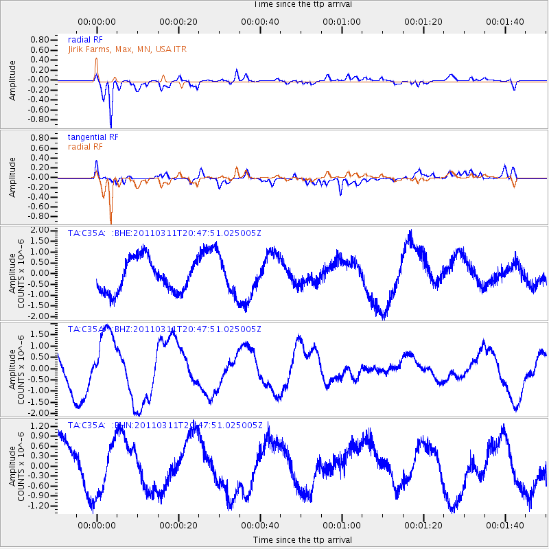
C35A Jirik Farms, Max, MN, USA - Earthquake Result Viewer
*The percent match for this event was below the threshold and hence no stack was calculated.
| Earthquake location: |
Off East Coast Of Honshu, Japan |
| Earthquake latitude/longitude: |
37.8/142.8 |
| Earthquake time(UTC): |
2011/03/11 (070) 20:36:10 GMT |
| Earthquake Depth: |
26 km |
| Earthquake Magnitude: |
5.5 MB |
| Earthquake Catalog/Contributor: |
WHDF/NEIC |
|
| Network: |
TA USArray Transportable Network (new EarthScope stations) |
| Station: |
C35A Jirik Farms, Max, MN, USA |
| Lat/Lon: |
47.70 N/93.98 W |
| Elevation: |
426 m |
|
| Distance: |
80.9 deg |
| Az: |
34.917 deg |
| Baz: |
317.857 deg |
| Ray Param: |
$rayparam |
*The percent match for this event was below the threshold and hence was not used in the summary stack. |
|
| Radial Match: |
77.135056 % |
| Radial Bump: |
400 |
| Transverse Match: |
72.4384 % |
| Transverse Bump: |
400 |
| SOD ConfigId: |
356183 |
| Insert Time: |
2011-08-18 15:01:22.719 +0000 |
| GWidth: |
2.5 |
| Max Bumps: |
400 |
| Tol: |
0.001 |
|
Signal To Noise
| Channel | StoN | STA | LTA |
| TA:C35A: :BHZ:20110311T20:47:51.025005Z | 1.669524 | 1.4158873E-6 | 8.480784E-7 |
| TA:C35A: :BHN:20110311T20:47:51.025005Z | 1.1745479 | 8.0846183E-7 | 6.8831747E-7 |
| TA:C35A: :BHE:20110311T20:47:51.025005Z | 1.227148 | 9.081265E-7 | 7.4003003E-7 |
| Arrivals |
| Ps | |
| PpPs | |
| PsPs/PpSs | |


