You are here: Home > Network List > US - United States National Seismic Network Stations List
> Station EGMT Eagleton, Montana, USA > Earthquake Result Viewer
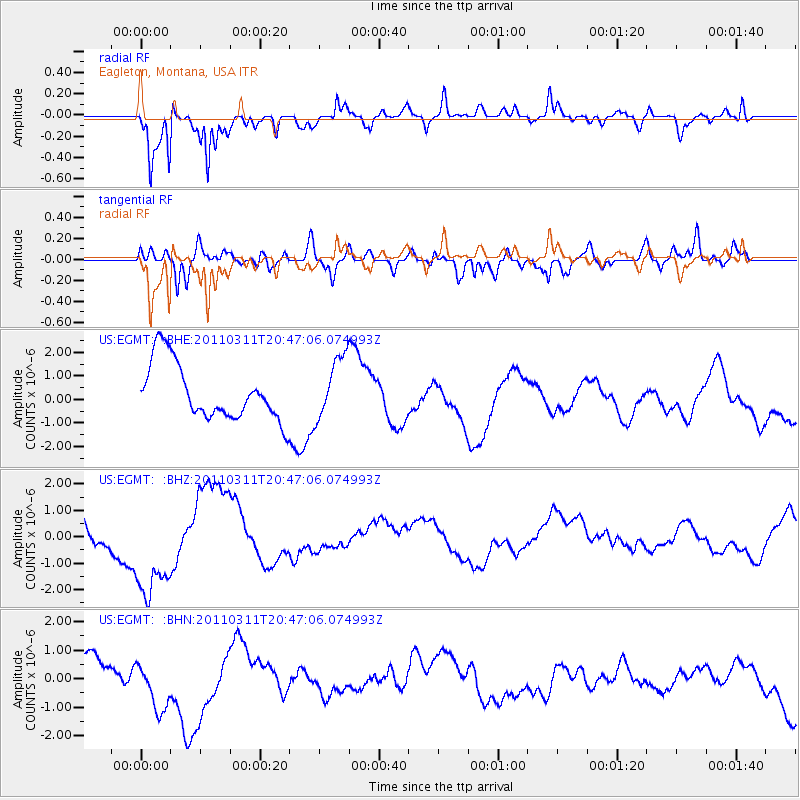
EGMT Eagleton, Montana, USA - Earthquake Result Viewer
*The percent match for this event was below the threshold and hence no stack was calculated.
| Earthquake location: |
Off East Coast Of Honshu, Japan |
| Earthquake latitude/longitude: |
37.8/142.8 |
| Earthquake time(UTC): |
2011/03/11 (070) 20:36:10 GMT |
| Earthquake Depth: |
26 km |
| Earthquake Magnitude: |
5.5 MB |
| Earthquake Catalog/Contributor: |
WHDF/NEIC |
|
| Network: |
US United States National Seismic Network |
| Station: |
EGMT Eagleton, Montana, USA |
| Lat/Lon: |
48.02 N/109.75 W |
| Elevation: |
1055 m |
|
| Distance: |
72.9 deg |
| Az: |
42.07 deg |
| Baz: |
307.782 deg |
| Ray Param: |
$rayparam |
*The percent match for this event was below the threshold and hence was not used in the summary stack. |
|
| Radial Match: |
73.18425 % |
| Radial Bump: |
391 |
| Transverse Match: |
46.365894 % |
| Transverse Bump: |
400 |
| SOD ConfigId: |
356183 |
| Insert Time: |
2011-08-18 15:12:40.142 +0000 |
| GWidth: |
2.5 |
| Max Bumps: |
400 |
| Tol: |
0.001 |
|
Signal To Noise
| Channel | StoN | STA | LTA |
| US:EGMT: :BHZ:20110311T20:47:06.074993Z | 2.6703684 | 2.0404445E-6 | 7.6410595E-7 |
| US:EGMT: :BHN:20110311T20:47:06.074993Z | 1.3894503 | 9.113247E-7 | 6.558887E-7 |
| US:EGMT: :BHE:20110311T20:47:06.074993Z | 1.1013436 | 1.3131151E-6 | 1.1922847E-6 |
| Arrivals |
| Ps | |
| PpPs | |
| PsPs/PpSs | |


