You are here: Home > Network List > AZ - ANZA Regional Network Stations List
> Station SMER AZ.SMER > Earthquake Result Viewer
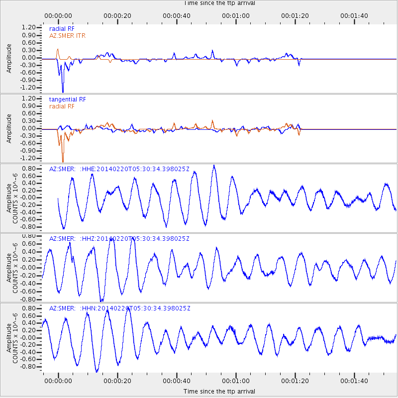
SMER AZ.SMER - Earthquake Result Viewer
*The percent match for this event was below the threshold and hence no stack was calculated.
| Earthquake location: |
South Of Kermadec Islands |
| Earthquake latitude/longitude: |
-32.3/-178.6 |
| Earthquake time(UTC): |
2014/02/20 (051) 05:18:23 GMT |
| Earthquake Depth: |
46 km |
| Earthquake Magnitude: |
5.1 MW |
| Earthquake Catalog/Contributor: |
ISC/ISC |
|
| Network: |
AZ ANZA Regional Network |
| Station: |
SMER AZ.SMER |
| Lat/Lon: |
33.46 N/117.17 W |
| Elevation: |
355 m |
|
| Distance: |
87.3 deg |
| Az: |
47.283 deg |
| Baz: |
228.07 deg |
| Ray Param: |
$rayparam |
*The percent match for this event was below the threshold and hence was not used in the summary stack. |
|
| Radial Match: |
82.902695 % |
| Radial Bump: |
400 |
| Transverse Match: |
53.30974 % |
| Transverse Bump: |
400 |
| SOD ConfigId: |
3390531 |
| Insert Time: |
2019-04-10 09:51:33.596 +0000 |
| GWidth: |
2.5 |
| Max Bumps: |
400 |
| Tol: |
0.001 |
|
Signal To Noise
| Channel | StoN | STA | LTA |
| AZ:SMER: :HHZ:20140220T05:30:34.398025Z | 1.8078036 | 4.2857397E-7 | 2.3706889E-7 |
| AZ:SMER: :HHN:20140220T05:30:34.398025Z | 1.5030626 | 3.6704444E-7 | 2.441977E-7 |
| AZ:SMER: :HHE:20140220T05:30:34.398025Z | 0.84331596 | 3.0798526E-7 | 3.6520743E-7 |
| Arrivals |
| Ps | |
| PpPs | |
| PsPs/PpSs | |


