You are here: Home > Network List > II - Global Seismograph Network (GSN - IRIS/IDA) Stations List
> Station WRAB Tennant Creek, NT, Australia > Earthquake Result Viewer
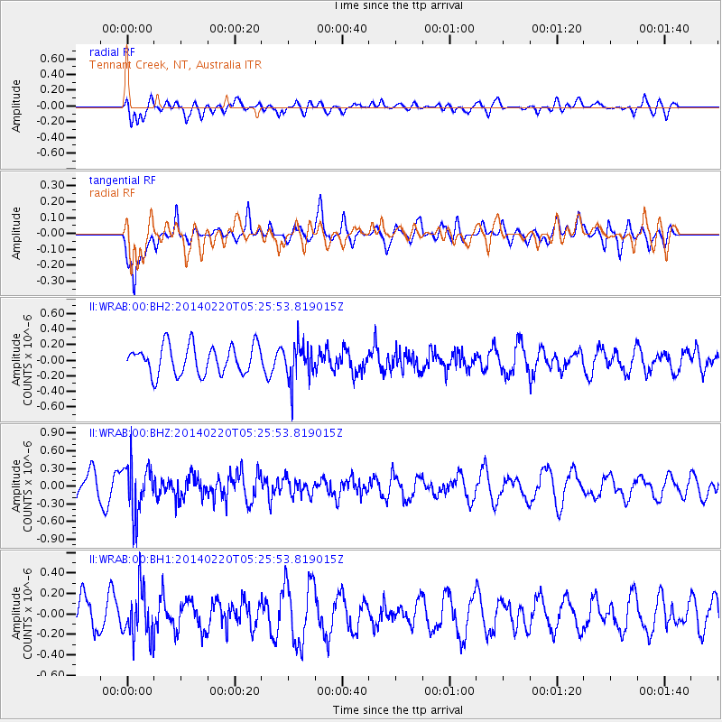
WRAB Tennant Creek, NT, Australia - Earthquake Result Viewer
*The percent match for this event was below the threshold and hence no stack was calculated.
| Earthquake location: |
South Of Kermadec Islands |
| Earthquake latitude/longitude: |
-32.3/-178.6 |
| Earthquake time(UTC): |
2014/02/20 (051) 05:18:23 GMT |
| Earthquake Depth: |
46 km |
| Earthquake Magnitude: |
5.1 MW |
| Earthquake Catalog/Contributor: |
ISC/ISC |
|
| Network: |
II Global Seismograph Network (GSN - IRIS/IDA) |
| Station: |
WRAB Tennant Creek, NT, Australia |
| Lat/Lon: |
19.93 S/134.36 E |
| Elevation: |
366 m |
|
| Distance: |
43.7 deg |
| Az: |
274.496 deg |
| Baz: |
116.233 deg |
| Ray Param: |
$rayparam |
*The percent match for this event was below the threshold and hence was not used in the summary stack. |
|
| Radial Match: |
58.89524 % |
| Radial Bump: |
400 |
| Transverse Match: |
59.122463 % |
| Transverse Bump: |
400 |
| SOD ConfigId: |
3390531 |
| Insert Time: |
2019-04-10 09:52:40.904 +0000 |
| GWidth: |
2.5 |
| Max Bumps: |
400 |
| Tol: |
0.001 |
|
Signal To Noise
| Channel | StoN | STA | LTA |
| II:WRAB:00:BHZ:20140220T05:25:53.819015Z | 1.5616924 | 4.2221492E-7 | 2.703573E-7 |
| II:WRAB:00:BH1:20140220T05:25:53.819015Z | 1.6078087 | 2.4006243E-7 | 1.4931032E-7 |
| II:WRAB:00:BH2:20140220T05:25:53.819015Z | 1.2871784 | 2.3811486E-7 | 1.8498979E-7 |
| Arrivals |
| Ps | |
| PpPs | |
| PsPs/PpSs | |


