You are here: Home > Network List > TA - USArray Transportable Network (new EarthScope stations) Stations List
> Station E36A McGregor, MN, USA > Earthquake Result Viewer
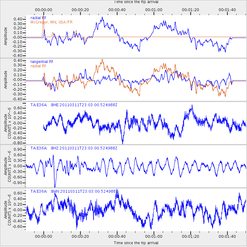
E36A McGregor, MN, USA - Earthquake Result Viewer
*The percent match for this event was below the threshold and hence no stack was calculated.
| Earthquake location: |
Off East Coast Of Honshu, Japan |
| Earthquake latitude/longitude: |
37.8/144.8 |
| Earthquake time(UTC): |
2011/03/11 (070) 22:51:19 GMT |
| Earthquake Depth: |
39 km |
| Earthquake Magnitude: |
5.7 MB |
| Earthquake Catalog/Contributor: |
WHDF/NEIC |
|
| Network: |
TA USArray Transportable Network (new EarthScope stations) |
| Station: |
E36A McGregor, MN, USA |
| Lat/Lon: |
46.52 N/93.26 W |
| Elevation: |
393 m |
|
| Distance: |
81.2 deg |
| Az: |
36.378 deg |
| Baz: |
317.153 deg |
| Ray Param: |
$rayparam |
*The percent match for this event was below the threshold and hence was not used in the summary stack. |
|
| Radial Match: |
40.398987 % |
| Radial Bump: |
400 |
| Transverse Match: |
52.00161 % |
| Transverse Bump: |
400 |
| SOD ConfigId: |
356183 |
| Insert Time: |
2011-08-18 16:51:40.376 +0000 |
| GWidth: |
2.5 |
| Max Bumps: |
400 |
| Tol: |
0.001 |
|
Signal To Noise
| Channel | StoN | STA | LTA |
| TA:E36A: :BHZ:20110311T23:03:00.524988Z | 1.6004661 | 2.4873376E-7 | 1.5541332E-7 |
| TA:E36A: :BHN:20110311T23:03:00.524988Z | 1.535836 | 2.782518E-7 | 1.8117285E-7 |
| TA:E36A: :BHE:20110311T23:03:00.524988Z | 1.2168518 | 2.3551974E-7 | 1.935484E-7 |
| Arrivals |
| Ps | |
| PpPs | |
| PsPs/PpSs | |


