You are here: Home > Network List > TA - USArray Transportable Network (new EarthScope stations) Stations List
> Station P38A Dawn, MO, USA > Earthquake Result Viewer
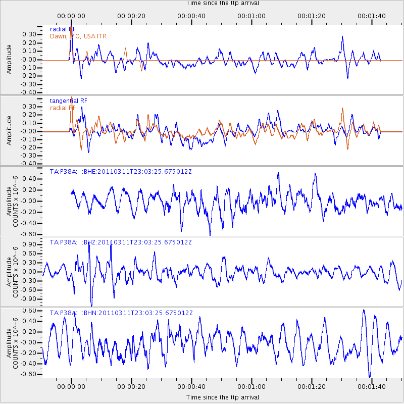
P38A Dawn, MO, USA - Earthquake Result Viewer
*The percent match for this event was below the threshold and hence no stack was calculated.
| Earthquake location: |
Off East Coast Of Honshu, Japan |
| Earthquake latitude/longitude: |
37.8/144.8 |
| Earthquake time(UTC): |
2011/03/11 (070) 22:51:19 GMT |
| Earthquake Depth: |
39 km |
| Earthquake Magnitude: |
5.7 MB |
| Earthquake Catalog/Contributor: |
WHDF/NEIC |
|
| Network: |
TA USArray Transportable Network (new EarthScope stations) |
| Station: |
P38A Dawn, MO, USA |
| Lat/Lon: |
39.62 N/93.53 W |
| Elevation: |
248 m |
|
| Distance: |
86.1 deg |
| Az: |
41.225 deg |
| Baz: |
317.498 deg |
| Ray Param: |
$rayparam |
*The percent match for this event was below the threshold and hence was not used in the summary stack. |
|
| Radial Match: |
51.54578 % |
| Radial Bump: |
368 |
| Transverse Match: |
58.952778 % |
| Transverse Bump: |
328 |
| SOD ConfigId: |
356183 |
| Insert Time: |
2011-08-18 16:54:23.498 +0000 |
| GWidth: |
2.5 |
| Max Bumps: |
400 |
| Tol: |
0.001 |
|
Signal To Noise
| Channel | StoN | STA | LTA |
| TA:P38A: :BHZ:20110311T23:03:25.675012Z | 2.2225616 | 2.8843962E-7 | 1.29778E-7 |
| TA:P38A: :BHN:20110311T23:03:25.675012Z | 1.4252962 | 2.7265034E-7 | 1.9129381E-7 |
| TA:P38A: :BHE:20110311T23:03:25.675012Z | 0.90217644 | 1.2454431E-7 | 1.3804873E-7 |
| Arrivals |
| Ps | |
| PpPs | |
| PsPs/PpSs | |


