You are here: Home > Network List > TA - USArray Transportable Network (new EarthScope stations) Stations List
> Station V39A Pettigrew, AR, USA > Earthquake Result Viewer
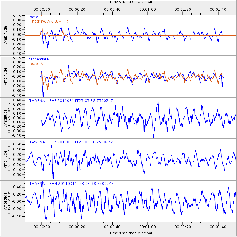
V39A Pettigrew, AR, USA - Earthquake Result Viewer
*The percent match for this event was below the threshold and hence no stack was calculated.
| Earthquake location: |
Off East Coast Of Honshu, Japan |
| Earthquake latitude/longitude: |
37.8/144.8 |
| Earthquake time(UTC): |
2011/03/11 (070) 22:51:19 GMT |
| Earthquake Depth: |
39 km |
| Earthquake Magnitude: |
5.7 MB |
| Earthquake Catalog/Contributor: |
WHDF/NEIC |
|
| Network: |
TA USArray Transportable Network (new EarthScope stations) |
| Station: |
V39A Pettigrew, AR, USA |
| Lat/Lon: |
35.84 N/93.64 W |
| Elevation: |
744 m |
|
| Distance: |
88.9 deg |
| Az: |
43.846 deg |
| Baz: |
317.543 deg |
| Ray Param: |
$rayparam |
*The percent match for this event was below the threshold and hence was not used in the summary stack. |
|
| Radial Match: |
45.10815 % |
| Radial Bump: |
386 |
| Transverse Match: |
61.638527 % |
| Transverse Bump: |
400 |
| SOD ConfigId: |
356183 |
| Insert Time: |
2011-08-18 17:00:17.919 +0000 |
| GWidth: |
2.5 |
| Max Bumps: |
400 |
| Tol: |
0.001 |
|
Signal To Noise
| Channel | StoN | STA | LTA |
| TA:V39A: :BHZ:20110311T23:03:38.750024Z | 1.0934527 | 2.0381987E-7 | 1.8640026E-7 |
| TA:V39A: :BHN:20110311T23:03:38.750024Z | 2.0839748 | 3.3262035E-7 | 1.5960862E-7 |
| TA:V39A: :BHE:20110311T23:03:38.750024Z | 1.1122568 | 1.4160528E-7 | 1.2731348E-7 |
| Arrivals |
| Ps | |
| PpPs | |
| PsPs/PpSs | |


