You are here: Home > Network List > IU - Global Seismograph Network (GSN - IRIS/USGS) Stations List
> Station JOHN Johnston Island, USA > Earthquake Result Viewer
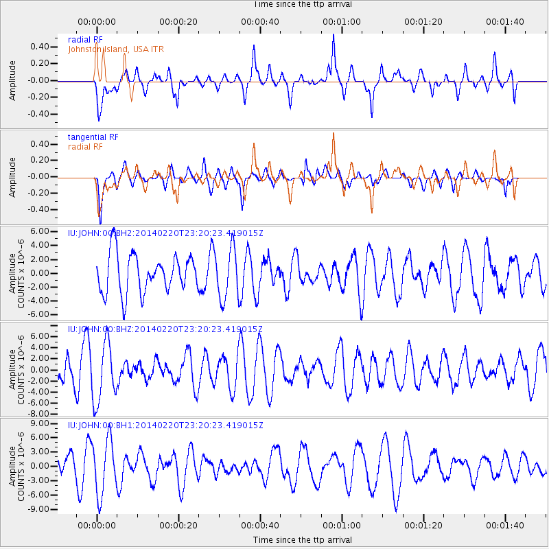
JOHN Johnston Island, USA - Earthquake Result Viewer
*The percent match for this event was below the threshold and hence no stack was calculated.
| Earthquake location: |
Hokkaido, Japan Region |
| Earthquake latitude/longitude: |
45.9/142.6 |
| Earthquake time(UTC): |
2014/02/20 (051) 23:12:38 GMT |
| Earthquake Depth: |
324 km |
| Earthquake Magnitude: |
5.2 MW |
| Earthquake Catalog/Contributor: |
ISC/ISC |
|
| Network: |
IU Global Seismograph Network (GSN - IRIS/USGS) |
| Station: |
JOHN Johnston Island, USA |
| Lat/Lon: |
16.73 N/169.53 W |
| Elevation: |
2.0 m |
|
| Distance: |
49.1 deg |
| Az: |
110.129 deg |
| Baz: |
316.792 deg |
| Ray Param: |
$rayparam |
*The percent match for this event was below the threshold and hence was not used in the summary stack. |
|
| Radial Match: |
68.42136 % |
| Radial Bump: |
400 |
| Transverse Match: |
46.169617 % |
| Transverse Bump: |
400 |
| SOD ConfigId: |
3390531 |
| Insert Time: |
2019-04-10 09:57:19.509 +0000 |
| GWidth: |
2.5 |
| Max Bumps: |
400 |
| Tol: |
0.001 |
|
Signal To Noise
| Channel | StoN | STA | LTA |
| IU:JOHN:00:BHZ:20140220T23:20:23.419015Z | 2.0995593 | 5.4288903E-6 | 2.5857285E-6 |
| IU:JOHN:00:BH1:20140220T23:20:23.419015Z | 1.7814469 | 5.785443E-6 | 3.2476091E-6 |
| IU:JOHN:00:BH2:20140220T23:20:23.419015Z | 1.3133377 | 3.6556673E-6 | 2.7834938E-6 |
| Arrivals |
| Ps | |
| PpPs | |
| PsPs/PpSs | |


