You are here: Home > Network List > IW - Intermountain West Stations List
> Station MOOW Moose Ponds, Wyoming, USA > Earthquake Result Viewer
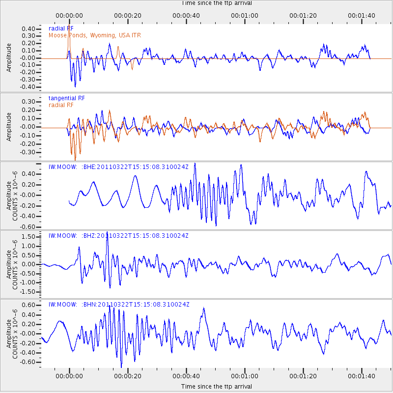
MOOW Moose Ponds, Wyoming, USA - Earthquake Result Viewer
*The percent match for this event was below the threshold and hence no stack was calculated.
| Earthquake location: |
Near East Coast Of Honshu, Japan |
| Earthquake latitude/longitude: |
35.8/141.6 |
| Earthquake time(UTC): |
2011/03/22 (081) 15:03:49 GMT |
| Earthquake Depth: |
35 km |
| Earthquake Magnitude: |
6.0 MB, 5.6 MS, 5.6 MW |
| Earthquake Catalog/Contributor: |
WHDF/NEIC |
|
| Network: |
IW Intermountain West |
| Station: |
MOOW Moose Ponds, Wyoming, USA |
| Lat/Lon: |
43.75 N/110.74 W |
| Elevation: |
2128 m |
|
| Distance: |
77.2 deg |
| Az: |
45.076 deg |
| Baz: |
307.411 deg |
| Ray Param: |
$rayparam |
*The percent match for this event was below the threshold and hence was not used in the summary stack. |
|
| Radial Match: |
66.899506 % |
| Radial Bump: |
400 |
| Transverse Match: |
49.397346 % |
| Transverse Bump: |
400 |
| SOD ConfigId: |
356183 |
| Insert Time: |
2011-08-18 18:38:33.185 +0000 |
| GWidth: |
2.5 |
| Max Bumps: |
400 |
| Tol: |
0.001 |
|
Signal To Noise
| Channel | StoN | STA | LTA |
| IW:MOOW: :BHZ:20110322T15:15:08.310024Z | 2.530056 | 4.4855207E-7 | 1.772894E-7 |
| IW:MOOW: :BHN:20110322T15:15:08.310024Z | 1.1288123 | 1.7962195E-7 | 1.5912472E-7 |
| IW:MOOW: :BHE:20110322T15:15:08.310024Z | 0.95648324 | 1.4899842E-7 | 1.5577736E-7 |
| Arrivals |
| Ps | |
| PpPs | |
| PsPs/PpSs | |


