You are here: Home > Network List > TA - USArray Transportable Network (new EarthScope stations) Stations List
> Station Q24A Divide, CO, USA > Earthquake Result Viewer
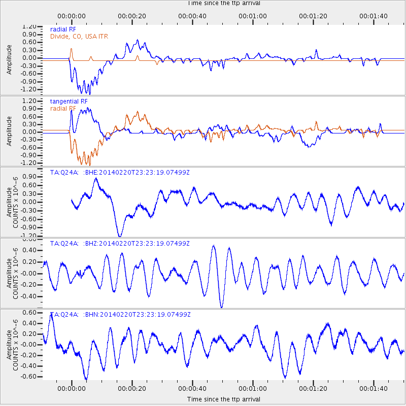
Q24A Divide, CO, USA - Earthquake Result Viewer
*The percent match for this event was below the threshold and hence no stack was calculated.
| Earthquake location: |
Hokkaido, Japan Region |
| Earthquake latitude/longitude: |
45.9/142.6 |
| Earthquake time(UTC): |
2014/02/20 (051) 23:12:38 GMT |
| Earthquake Depth: |
324 km |
| Earthquake Magnitude: |
5.2 MW |
| Earthquake Catalog/Contributor: |
ISC/ISC |
|
| Network: |
TA USArray Transportable Network (new EarthScope stations) |
| Station: |
Q24A Divide, CO, USA |
| Lat/Lon: |
38.96 N/105.15 W |
| Elevation: |
2775 m |
|
| Distance: |
76.0 deg |
| Az: |
48.065 deg |
| Baz: |
318.186 deg |
| Ray Param: |
$rayparam |
*The percent match for this event was below the threshold and hence was not used in the summary stack. |
|
| Radial Match: |
55.31993 % |
| Radial Bump: |
400 |
| Transverse Match: |
60.748768 % |
| Transverse Bump: |
400 |
| SOD ConfigId: |
3390531 |
| Insert Time: |
2019-04-10 10:00:09.100 +0000 |
| GWidth: |
2.5 |
| Max Bumps: |
400 |
| Tol: |
0.001 |
|
Signal To Noise
| Channel | StoN | STA | LTA |
| TA:Q24A: :BHZ:20140220T23:23:19.07499Z | 0.44165564 | 7.366294E-8 | 1.6678817E-7 |
| TA:Q24A: :BHN:20140220T23:23:19.07499Z | 1.7445545 | 3.8574294E-7 | 2.2111257E-7 |
| TA:Q24A: :BHE:20140220T23:23:19.07499Z | 0.8142294 | 3.9967486E-7 | 4.908627E-7 |
| Arrivals |
| Ps | |
| PpPs | |
| PsPs/PpSs | |


