You are here: Home > Network List > US - United States National Seismic Network Stations List
> Station EGMT Eagleton, Montana, USA > Earthquake Result Viewer
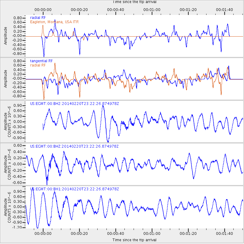
EGMT Eagleton, Montana, USA - Earthquake Result Viewer
*The percent match for this event was below the threshold and hence no stack was calculated.
| Earthquake location: |
Hokkaido, Japan Region |
| Earthquake latitude/longitude: |
45.9/142.6 |
| Earthquake time(UTC): |
2014/02/20 (051) 23:12:38 GMT |
| Earthquake Depth: |
324 km |
| Earthquake Magnitude: |
5.2 MW |
| Earthquake Catalog/Contributor: |
ISC/ISC |
|
| Network: |
US United States National Seismic Network |
| Station: |
EGMT Eagleton, Montana, USA |
| Lat/Lon: |
48.02 N/109.75 W |
| Elevation: |
1055 m |
|
| Distance: |
67.1 deg |
| Az: |
43.978 deg |
| Baz: |
313.72 deg |
| Ray Param: |
$rayparam |
*The percent match for this event was below the threshold and hence was not used in the summary stack. |
|
| Radial Match: |
52.353195 % |
| Radial Bump: |
400 |
| Transverse Match: |
52.44505 % |
| Transverse Bump: |
400 |
| SOD ConfigId: |
3390531 |
| Insert Time: |
2019-04-10 10:00:51.956 +0000 |
| GWidth: |
2.5 |
| Max Bumps: |
400 |
| Tol: |
0.001 |
|
Signal To Noise
| Channel | StoN | STA | LTA |
| US:EGMT:00:BHZ:20140220T23:22:26.874978Z | 1.4959939 | 2.720415E-7 | 1.8184667E-7 |
| US:EGMT:00:BH1:20140220T23:22:26.874978Z | 1.8558798 | 7.298578E-7 | 3.9326784E-7 |
| US:EGMT:00:BH2:20140220T23:22:26.874978Z | 2.3559515 | 6.2991325E-7 | 2.6737104E-7 |
| Arrivals |
| Ps | |
| PpPs | |
| PsPs/PpSs | |


