You are here: Home > Network List > TA - USArray Transportable Network (new EarthScope stations) Stations List
> Station D37A Cotton, MN, USA > Earthquake Result Viewer
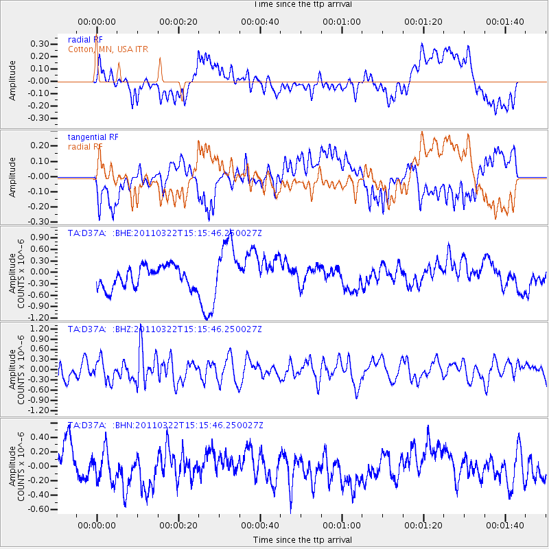
D37A Cotton, MN, USA - Earthquake Result Viewer
*The percent match for this event was below the threshold and hence no stack was calculated.
| Earthquake location: |
Near East Coast Of Honshu, Japan |
| Earthquake latitude/longitude: |
35.8/141.6 |
| Earthquake time(UTC): |
2011/03/22 (081) 15:03:49 GMT |
| Earthquake Depth: |
35 km |
| Earthquake Magnitude: |
6.0 MB, 5.6 MS, 5.6 MW |
| Earthquake Catalog/Contributor: |
WHDF/NEIC |
|
| Network: |
TA USArray Transportable Network (new EarthScope stations) |
| Station: |
D37A Cotton, MN, USA |
| Lat/Lon: |
47.16 N/92.43 W |
| Elevation: |
413 m |
|
| Distance: |
84.3 deg |
| Az: |
33.688 deg |
| Baz: |
318.641 deg |
| Ray Param: |
$rayparam |
*The percent match for this event was below the threshold and hence was not used in the summary stack. |
|
| Radial Match: |
48.11533 % |
| Radial Bump: |
400 |
| Transverse Match: |
50.652866 % |
| Transverse Bump: |
400 |
| SOD ConfigId: |
356183 |
| Insert Time: |
2011-08-18 19:27:00.187 +0000 |
| GWidth: |
2.5 |
| Max Bumps: |
400 |
| Tol: |
0.001 |
|
Signal To Noise
| Channel | StoN | STA | LTA |
| TA:D37A: :BHZ:20110322T15:15:46.250027Z | 1.4865816 | 3.1368174E-7 | 2.1100877E-7 |
| TA:D37A: :BHN:20110322T15:15:46.250027Z | 0.8858366 | 2.1608665E-7 | 2.439351E-7 |
| TA:D37A: :BHE:20110322T15:15:46.250027Z | 2.663064 | 7.357029E-7 | 2.7626183E-7 |
| Arrivals |
| Ps | |
| PpPs | |
| PsPs/PpSs | |


