You are here: Home > Network List > US - United States National Seismic Network Stations List
> Station EGMT Eagleton, Montana, USA > Earthquake Result Viewer
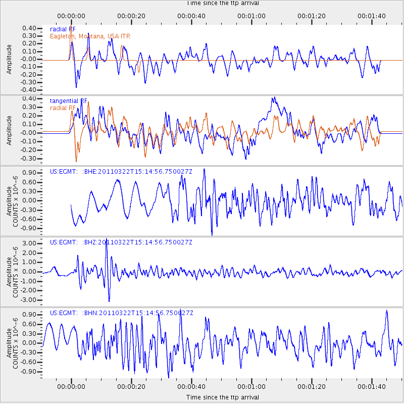
EGMT Eagleton, Montana, USA - Earthquake Result Viewer
*The percent match for this event was below the threshold and hence no stack was calculated.
| Earthquake location: |
Near East Coast Of Honshu, Japan |
| Earthquake latitude/longitude: |
35.8/141.6 |
| Earthquake time(UTC): |
2011/03/22 (081) 15:03:49 GMT |
| Earthquake Depth: |
35 km |
| Earthquake Magnitude: |
6.0 MB, 5.6 MS, 5.6 MW |
| Earthquake Catalog/Contributor: |
WHDF/NEIC |
|
| Network: |
US United States National Seismic Network |
| Station: |
EGMT Eagleton, Montana, USA |
| Lat/Lon: |
48.02 N/109.75 W |
| Elevation: |
1055 m |
|
| Distance: |
75.1 deg |
| Az: |
41.141 deg |
| Baz: |
307.177 deg |
| Ray Param: |
$rayparam |
*The percent match for this event was below the threshold and hence was not used in the summary stack. |
|
| Radial Match: |
61.612244 % |
| Radial Bump: |
400 |
| Transverse Match: |
47.125828 % |
| Transverse Bump: |
400 |
| SOD ConfigId: |
356183 |
| Insert Time: |
2011-08-18 19:48:25.283 +0000 |
| GWidth: |
2.5 |
| Max Bumps: |
400 |
| Tol: |
0.001 |
|
Signal To Noise
| Channel | StoN | STA | LTA |
| US:EGMT: :BHZ:20110322T15:14:56.750027Z | 3.185373 | 8.0973837E-7 | 2.542052E-7 |
| US:EGMT: :BHN:20110322T15:14:56.750027Z | 0.68553436 | 4.6196095E-7 | 6.7386986E-7 |
| US:EGMT: :BHE:20110322T15:14:56.750027Z | 1.0490643 | 4.258186E-7 | 4.0590325E-7 |
| Arrivals |
| Ps | |
| PpPs | |
| PsPs/PpSs | |


