You are here: Home > Network List > AZ - ANZA Regional Network Stations List
> Station PFO AZ.PFO > Earthquake Result Viewer
PFO AZ.PFO - Earthquake Result Viewer
*The percent match for this event was below the threshold and hence no stack was calculated.
| Earthquake location: |
Northern Mid-Atlantic Ridge |
| Earthquake latitude/longitude: |
24.5/-46.4 |
| Earthquake time(UTC): |
1999/04/06 (096) 04:51:05 GMT |
| Earthquake Depth: |
10 km |
| Earthquake Magnitude: |
5.6 MS, 5.3 MB, 5.9 MW, 5.8 MW |
| Earthquake Catalog/Contributor: |
WHDF/NEIC |
|
| Network: |
AZ ANZA Regional Network |
| Station: |
PFO AZ.PFO |
| Lat/Lon: |
33.61 N/116.46 W |
| Elevation: |
1259 m |
|
| Distance: |
60.9 deg |
| Az: |
296.145 deg |
| Baz: |
78.62 deg |
| Ray Param: |
$rayparam |
*The percent match for this event was below the threshold and hence was not used in the summary stack. |
|
| Radial Match: |
100.0 % |
| Radial Bump: |
2 |
| Transverse Match: |
100.0 % |
| Transverse Bump: |
2 |
| SOD ConfigId: |
4480 |
| Insert Time: |
2010-02-26 20:22:37.514 +0000 |
| GWidth: |
2.5 |
| Max Bumps: |
400 |
| Tol: |
0.001 |
|
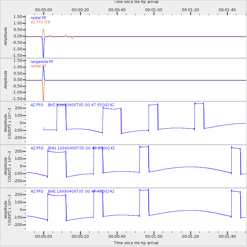
Signal To Noise
| Channel | StoN | STA | LTA |
| AZ:PFO: :BHN:19990406T05:00:47.650024Z | 1.2336704 | 0.16503222 | 0.13377336 |
| AZ:PFO: :BHE:19990406T05:00:47.650024Z | 1.2336725 | 0.16503318 | 0.1337739 |
| AZ:PFO: :BHZ:19990406T05:00:47.650024Z | 1.2336737 | 0.16503192 | 0.13377276 |
| Arrivals |
| Ps | |
| PpPs | |
| PsPs/PpSs | |


