You are here: Home > Network List > TA - USArray Transportable Network (new EarthScope stations) Stations List
> Station E25A Miller Ranch, Amidon, ND, USA > Earthquake Result Viewer
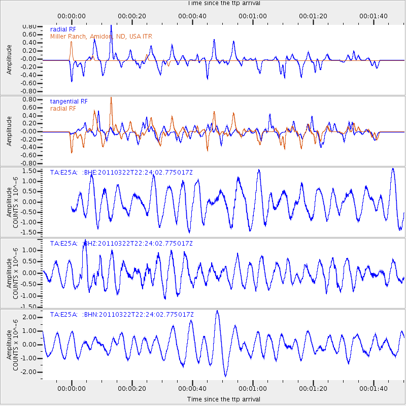
E25A Miller Ranch, Amidon, ND, USA - Earthquake Result Viewer
*The percent match for this event was below the threshold and hence no stack was calculated.
| Earthquake location: |
Eastern Honshu, Japan |
| Earthquake latitude/longitude: |
37.1/140.6 |
| Earthquake time(UTC): |
2011/03/22 (081) 22:12:31 GMT |
| Earthquake Depth: |
18 km |
| Earthquake Magnitude: |
5.5 MB, 5.4 MS, 5.7 MW, 5.5 MW |
| Earthquake Catalog/Contributor: |
WHDF/NEIC |
|
| Network: |
TA USArray Transportable Network (new EarthScope stations) |
| Station: |
E25A Miller Ranch, Amidon, ND, USA |
| Lat/Lon: |
46.50 N/103.40 W |
| Elevation: |
885 m |
|
| Distance: |
78.9 deg |
| Az: |
39.261 deg |
| Baz: |
312.876 deg |
| Ray Param: |
$rayparam |
*The percent match for this event was below the threshold and hence was not used in the summary stack. |
|
| Radial Match: |
50.967995 % |
| Radial Bump: |
312 |
| Transverse Match: |
49.548813 % |
| Transverse Bump: |
400 |
| SOD ConfigId: |
356183 |
| Insert Time: |
2011-08-18 21:17:36.234 +0000 |
| GWidth: |
2.5 |
| Max Bumps: |
400 |
| Tol: |
0.001 |
|
Signal To Noise
| Channel | StoN | STA | LTA |
| TA:E25A: :BHZ:20110322T22:24:02.775017Z | 2.9605153 | 7.0802E-7 | 2.3915433E-7 |
| TA:E25A: :BHN:20110322T22:24:02.775017Z | 1.0111531 | 6.2404314E-7 | 6.171599E-7 |
| TA:E25A: :BHE:20110322T22:24:02.775017Z | 1.2856008 | 6.937962E-7 | 5.396669E-7 |
| Arrivals |
| Ps | |
| PpPs | |
| PsPs/PpSs | |


