You are here: Home > Network List > US - United States National Seismic Network Stations List
> Station MIAR Mount Ida, Arkansas, USA > Earthquake Result Viewer
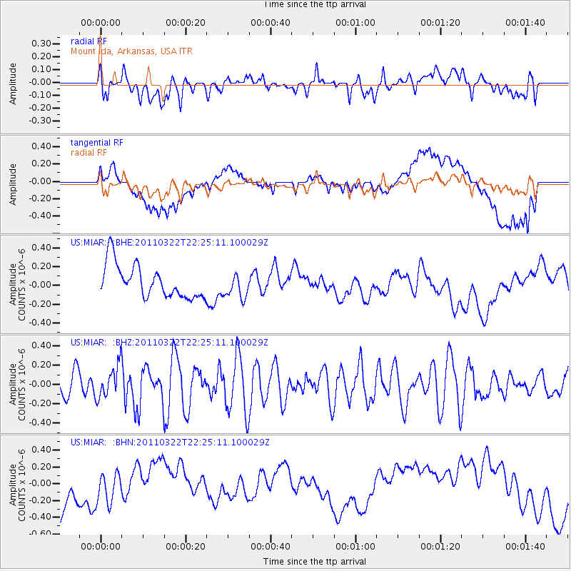
MIAR Mount Ida, Arkansas, USA - Earthquake Result Viewer
*The percent match for this event was below the threshold and hence no stack was calculated.
| Earthquake location: |
Eastern Honshu, Japan |
| Earthquake latitude/longitude: |
37.1/140.6 |
| Earthquake time(UTC): |
2011/03/22 (081) 22:12:31 GMT |
| Earthquake Depth: |
18 km |
| Earthquake Magnitude: |
5.5 MB, 5.4 MS, 5.7 MW, 5.5 MW |
| Earthquake Catalog/Contributor: |
WHDF/NEIC |
|
| Network: |
US United States National Seismic Network |
| Station: |
MIAR Mount Ida, Arkansas, USA |
| Lat/Lon: |
34.55 N/93.58 W |
| Elevation: |
207 m |
|
| Distance: |
92.7 deg |
| Az: |
42.095 deg |
| Baz: |
319.488 deg |
| Ray Param: |
$rayparam |
*The percent match for this event was below the threshold and hence was not used in the summary stack. |
|
| Radial Match: |
45.608345 % |
| Radial Bump: |
400 |
| Transverse Match: |
29.684095 % |
| Transverse Bump: |
400 |
| SOD ConfigId: |
356183 |
| Insert Time: |
2011-08-18 21:52:57.896 +0000 |
| GWidth: |
2.5 |
| Max Bumps: |
400 |
| Tol: |
0.001 |
|
Signal To Noise
| Channel | StoN | STA | LTA |
| US:MIAR: :BHZ:20110322T22:25:11.100029Z | 0.94806343 | 1.686549E-7 | 1.7789412E-7 |
| US:MIAR: :BHN:20110322T22:25:11.100029Z | 0.80491984 | 1.855446E-7 | 2.3051312E-7 |
| US:MIAR: :BHE:20110322T22:25:11.100029Z | 0.7316334 | 1.2900507E-7 | 1.7632475E-7 |
| Arrivals |
| Ps | |
| PpPs | |
| PsPs/PpSs | |


