You are here: Home > Network List > TA - USArray Transportable Network (new EarthScope stations) Stations List
> Station G36A St. Michael, MN, USA > Earthquake Result Viewer
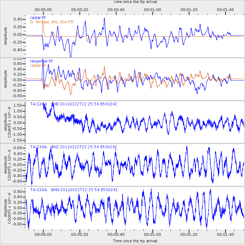
G36A St. Michael, MN, USA - Earthquake Result Viewer
*The percent match for this event was below the threshold and hence no stack was calculated.
| Earthquake location: |
Eastern Honshu, Japan |
| Earthquake latitude/longitude: |
37.0/140.7 |
| Earthquake time(UTC): |
2011/03/22 (081) 22:13:57 GMT |
| Earthquake Depth: |
41 km |
| Earthquake Magnitude: |
5.5 MB, 5.3 MS |
| Earthquake Catalog/Contributor: |
WHDF/NEIC |
|
| Network: |
TA USArray Transportable Network (new EarthScope stations) |
| Station: |
G36A St. Michael, MN, USA |
| Lat/Lon: |
45.23 N/93.75 W |
| Elevation: |
293 m |
|
| Distance: |
84.5 deg |
| Az: |
35.265 deg |
| Baz: |
319.153 deg |
| Ray Param: |
$rayparam |
*The percent match for this event was below the threshold and hence was not used in the summary stack. |
|
| Radial Match: |
48.897682 % |
| Radial Bump: |
400 |
| Transverse Match: |
38.85769 % |
| Transverse Bump: |
400 |
| SOD ConfigId: |
356183 |
| Insert Time: |
2011-08-18 22:34:26.166 +0000 |
| GWidth: |
2.5 |
| Max Bumps: |
400 |
| Tol: |
0.001 |
|
Signal To Noise
| Channel | StoN | STA | LTA |
| TA:G36A: :BHZ:20110322T22:25:54.850024Z | 1.2217389 | 3.0486675E-7 | 2.495351E-7 |
| TA:G36A: :BHN:20110322T22:25:54.850024Z | 0.77240425 | 3.4165132E-7 | 4.423219E-7 |
| TA:G36A: :BHE:20110322T22:25:54.850024Z | 1.7896606 | 8.912857E-7 | 4.980194E-7 |
| Arrivals |
| Ps | |
| PpPs | |
| PsPs/PpSs | |


