You are here: Home > Network List > TA - USArray Transportable Network (new EarthScope stations) Stations List
> Station V39A Pettigrew, AR, USA > Earthquake Result Viewer
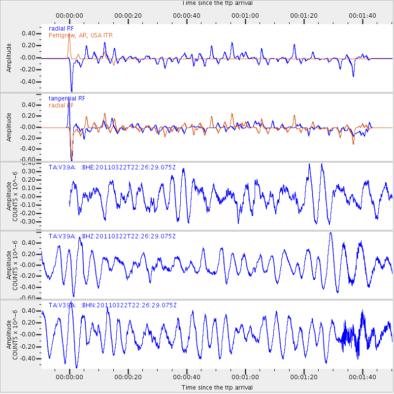
V39A Pettigrew, AR, USA - Earthquake Result Viewer
*The percent match for this event was below the threshold and hence no stack was calculated.
| Earthquake location: |
Eastern Honshu, Japan |
| Earthquake latitude/longitude: |
37.0/140.7 |
| Earthquake time(UTC): |
2011/03/22 (081) 22:13:57 GMT |
| Earthquake Depth: |
41 km |
| Earthquake Magnitude: |
5.5 MB, 5.3 MS |
| Earthquake Catalog/Contributor: |
WHDF/NEIC |
|
| Network: |
TA USArray Transportable Network (new EarthScope stations) |
| Station: |
V39A Pettigrew, AR, USA |
| Lat/Lon: |
35.84 N/93.64 W |
| Elevation: |
744 m |
|
| Distance: |
91.7 deg |
| Az: |
41.325 deg |
| Baz: |
319.421 deg |
| Ray Param: |
$rayparam |
*The percent match for this event was below the threshold and hence was not used in the summary stack. |
|
| Radial Match: |
45.706146 % |
| Radial Bump: |
400 |
| Transverse Match: |
65.388954 % |
| Transverse Bump: |
400 |
| SOD ConfigId: |
356183 |
| Insert Time: |
2011-08-18 22:39:54.392 +0000 |
| GWidth: |
2.5 |
| Max Bumps: |
400 |
| Tol: |
0.001 |
|
Signal To Noise
| Channel | StoN | STA | LTA |
| TA:V39A: :BHZ:20110322T22:26:29.075Z | 1.9342345 | 3.298102E-7 | 1.7051201E-7 |
| TA:V39A: :BHN:20110322T22:26:29.075Z | 1.6435627 | 3.61388E-7 | 2.1988087E-7 |
| TA:V39A: :BHE:20110322T22:26:29.075Z | 1.1398052 | 1.2187566E-7 | 1.0692674E-7 |
| Arrivals |
| Ps | |
| PpPs | |
| PsPs/PpSs | |


