You are here: Home > Network List > UW - Pacific Northwest Regional Seismic Network Stations List
> Station MRBL Marblemount, WA, USA > Earthquake Result Viewer
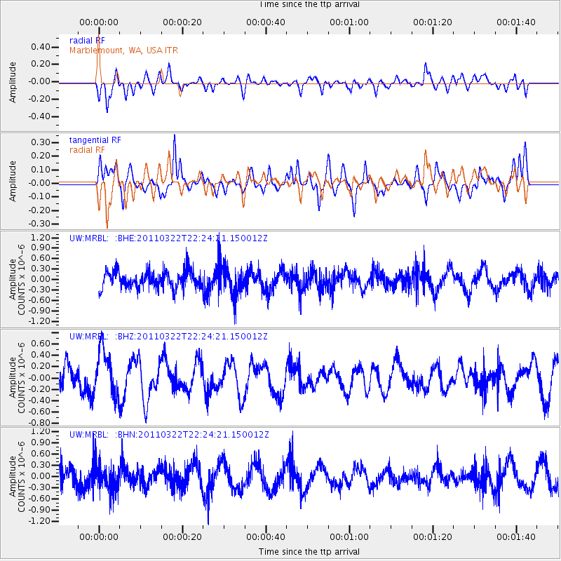
MRBL Marblemount, WA, USA - Earthquake Result Viewer
*The percent match for this event was below the threshold and hence no stack was calculated.
| Earthquake location: |
Eastern Honshu, Japan |
| Earthquake latitude/longitude: |
37.0/140.7 |
| Earthquake time(UTC): |
2011/03/22 (081) 22:13:57 GMT |
| Earthquake Depth: |
41 km |
| Earthquake Magnitude: |
5.5 MB, 5.3 MS |
| Earthquake Catalog/Contributor: |
WHDF/NEIC |
|
| Network: |
UW Pacific Northwest Regional Seismic Network |
| Station: |
MRBL Marblemount, WA, USA |
| Lat/Lon: |
48.52 N/121.48 W |
| Elevation: |
75 m |
|
| Distance: |
68.0 deg |
| Az: |
45.282 deg |
| Baz: |
301.191 deg |
| Ray Param: |
$rayparam |
*The percent match for this event was below the threshold and hence was not used in the summary stack. |
|
| Radial Match: |
61.007385 % |
| Radial Bump: |
400 |
| Transverse Match: |
63.90787 % |
| Transverse Bump: |
400 |
| SOD ConfigId: |
356183 |
| Insert Time: |
2011-08-18 22:43:49.181 +0000 |
| GWidth: |
2.5 |
| Max Bumps: |
400 |
| Tol: |
0.001 |
|
Signal To Noise
| Channel | StoN | STA | LTA |
| UW:MRBL: :BHZ:20110322T22:24:21.150012Z | 1.0185196 | 3.951115E-7 | 3.8792723E-7 |
| UW:MRBL: :BHN:20110322T22:24:21.150012Z | 1.418593 | 3.4347084E-7 | 2.4212076E-7 |
| UW:MRBL: :BHE:20110322T22:24:21.150012Z | 1.7197311 | 4.1512402E-7 | 2.413889E-7 |
| Arrivals |
| Ps | |
| PpPs | |
| PsPs/PpSs | |


