You are here: Home > Network List > TA - USArray Transportable Network (new EarthScope stations) Stations List
> Station H28A Mission Ridge, SD, USA > Earthquake Result Viewer
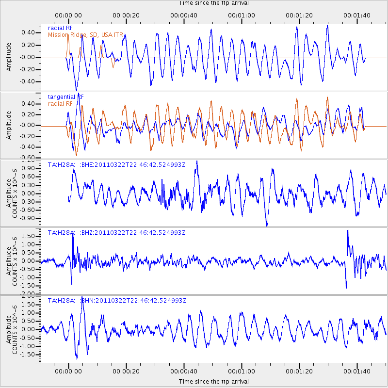
H28A Mission Ridge, SD, USA - Earthquake Result Viewer
*The percent match for this event was below the threshold and hence no stack was calculated.
| Earthquake location: |
Eastern Honshu, Japan |
| Earthquake latitude/longitude: |
37.1/140.6 |
| Earthquake time(UTC): |
2011/03/22 (081) 22:35:00 GMT |
| Earthquake Depth: |
38 km |
| Earthquake Magnitude: |
5.5 MB |
| Earthquake Catalog/Contributor: |
WHDF/NEIC |
|
| Network: |
TA USArray Transportable Network (new EarthScope stations) |
| Station: |
H28A Mission Ridge, SD, USA |
| Lat/Lon: |
44.68 N/101.02 W |
| Elevation: |
642 m |
|
| Distance: |
81.4 deg |
| Az: |
39.402 deg |
| Baz: |
314.666 deg |
| Ray Param: |
$rayparam |
*The percent match for this event was below the threshold and hence was not used in the summary stack. |
|
| Radial Match: |
61.290405 % |
| Radial Bump: |
400 |
| Transverse Match: |
47.123028 % |
| Transverse Bump: |
400 |
| SOD ConfigId: |
356183 |
| Insert Time: |
2011-08-18 23:09:12.789 +0000 |
| GWidth: |
2.5 |
| Max Bumps: |
400 |
| Tol: |
0.001 |
|
Signal To Noise
| Channel | StoN | STA | LTA |
| TA:H28A: :BHZ:20110322T22:46:42.524993Z | 3.5334394 | 5.6112304E-7 | 1.5880364E-7 |
| TA:H28A: :BHN:20110322T22:46:42.524993Z | 3.460359 | 9.4735896E-7 | 2.7377476E-7 |
| TA:H28A: :BHE:20110322T22:46:42.524993Z | 1.0368311 | 3.144989E-7 | 3.0332703E-7 |
| Arrivals |
| Ps | |
| PpPs | |
| PsPs/PpSs | |


