You are here: Home > Network List > TA - USArray Transportable Network (new EarthScope stations) Stations List
> Station H26A Fairpoint, SD, USA > Earthquake Result Viewer
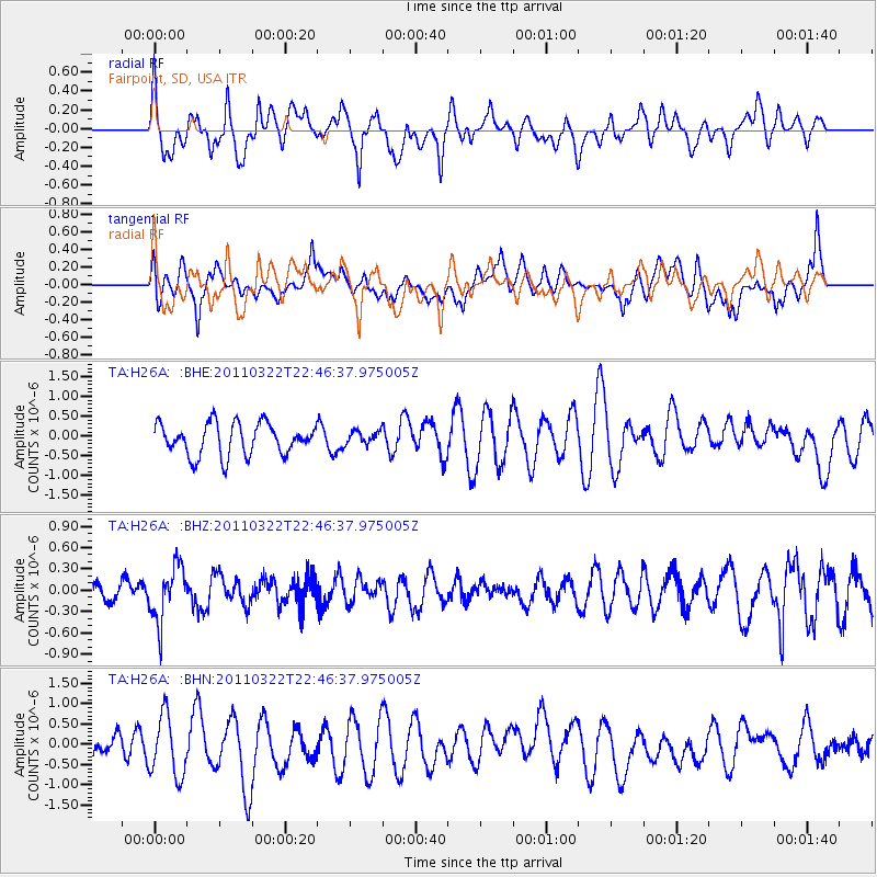
H26A Fairpoint, SD, USA - Earthquake Result Viewer
*The percent match for this event was below the threshold and hence no stack was calculated.
| Earthquake location: |
Eastern Honshu, Japan |
| Earthquake latitude/longitude: |
37.1/140.6 |
| Earthquake time(UTC): |
2011/03/22 (081) 22:35:00 GMT |
| Earthquake Depth: |
38 km |
| Earthquake Magnitude: |
5.5 MB |
| Earthquake Catalog/Contributor: |
WHDF/NEIC |
|
| Network: |
TA USArray Transportable Network (new EarthScope stations) |
| Station: |
H26A Fairpoint, SD, USA |
| Lat/Lon: |
44.62 N/102.77 W |
| Elevation: |
879 m |
|
| Distance: |
80.5 deg |
| Az: |
40.326 deg |
| Baz: |
313.583 deg |
| Ray Param: |
$rayparam |
*The percent match for this event was below the threshold and hence was not used in the summary stack. |
|
| Radial Match: |
48.79963 % |
| Radial Bump: |
400 |
| Transverse Match: |
39.69266 % |
| Transverse Bump: |
400 |
| SOD ConfigId: |
356183 |
| Insert Time: |
2011-08-18 23:09:37.565 +0000 |
| GWidth: |
2.5 |
| Max Bumps: |
400 |
| Tol: |
0.001 |
|
Signal To Noise
| Channel | StoN | STA | LTA |
| TA:H26A: :BHZ:20110322T22:46:37.975005Z | 2.8935173 | 3.91884E-7 | 1.3543516E-7 |
| TA:H26A: :BHN:20110322T22:46:37.975005Z | 2.0722907 | 7.6162854E-7 | 3.6752982E-7 |
| TA:H26A: :BHE:20110322T22:46:37.975005Z | 0.42505348 | 1.7092887E-7 | 4.02135E-7 |
| Arrivals |
| Ps | |
| PpPs | |
| PsPs/PpSs | |


