You are here: Home > Network List > TA - USArray Transportable Network (new EarthScope stations) Stations List
> Station O03D Paynes Creek, CA, USA > Earthquake Result Viewer
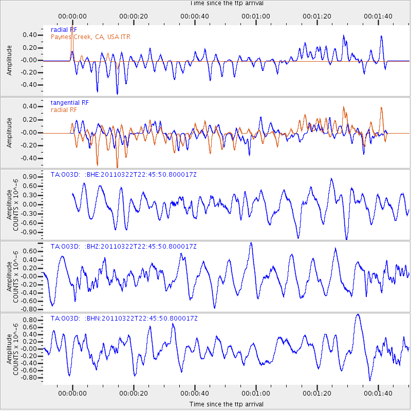
O03D Paynes Creek, CA, USA - Earthquake Result Viewer
*The percent match for this event was below the threshold and hence no stack was calculated.
| Earthquake location: |
Eastern Honshu, Japan |
| Earthquake latitude/longitude: |
37.1/140.6 |
| Earthquake time(UTC): |
2011/03/22 (081) 22:35:00 GMT |
| Earthquake Depth: |
38 km |
| Earthquake Magnitude: |
5.5 MB |
| Earthquake Catalog/Contributor: |
WHDF/NEIC |
|
| Network: |
TA USArray Transportable Network (new EarthScope stations) |
| Station: |
O03D Paynes Creek, CA, USA |
| Lat/Lon: |
40.29 N/121.80 W |
| Elevation: |
968 m |
|
| Distance: |
72.2 deg |
| Az: |
52.778 deg |
| Baz: |
303.668 deg |
| Ray Param: |
$rayparam |
*The percent match for this event was below the threshold and hence was not used in the summary stack. |
|
| Radial Match: |
48.705738 % |
| Radial Bump: |
400 |
| Transverse Match: |
59.784225 % |
| Transverse Bump: |
400 |
| SOD ConfigId: |
356183 |
| Insert Time: |
2011-08-18 23:19:32.438 +0000 |
| GWidth: |
2.5 |
| Max Bumps: |
400 |
| Tol: |
0.001 |
|
Signal To Noise
| Channel | StoN | STA | LTA |
| TA:O03D: :BHZ:20110322T22:45:50.800017Z | 0.54203403 | 2.2359126E-7 | 4.125041E-7 |
| TA:O03D: :BHN:20110322T22:45:50.800017Z | 1.1428102 | 3.3595862E-7 | 2.9397586E-7 |
| TA:O03D: :BHE:20110322T22:45:50.800017Z | 0.5080197 | 1.890474E-7 | 3.7212615E-7 |
| Arrivals |
| Ps | |
| PpPs | |
| PsPs/PpSs | |


