You are here: Home > Network List > TA - USArray Transportable Network (new EarthScope stations) Stations List
> Station E31A Nome, ND, USA > Earthquake Result Viewer
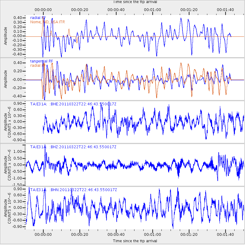
E31A Nome, ND, USA - Earthquake Result Viewer
*The percent match for this event was below the threshold and hence no stack was calculated.
| Earthquake location: |
Eastern Honshu, Japan |
| Earthquake latitude/longitude: |
37.1/140.6 |
| Earthquake time(UTC): |
2011/03/22 (081) 22:35:00 GMT |
| Earthquake Depth: |
38 km |
| Earthquake Magnitude: |
5.5 MB |
| Earthquake Catalog/Contributor: |
WHDF/NEIC |
|
| Network: |
TA USArray Transportable Network (new EarthScope stations) |
| Station: |
E31A Nome, ND, USA |
| Lat/Lon: |
46.56 N/97.89 W |
| Elevation: |
427 m |
|
| Distance: |
81.6 deg |
| Az: |
36.481 deg |
| Baz: |
316.465 deg |
| Ray Param: |
$rayparam |
*The percent match for this event was below the threshold and hence was not used in the summary stack. |
|
| Radial Match: |
53.944683 % |
| Radial Bump: |
400 |
| Transverse Match: |
49.423523 % |
| Transverse Bump: |
400 |
| SOD ConfigId: |
356183 |
| Insert Time: |
2011-08-18 23:20:01.012 +0000 |
| GWidth: |
2.5 |
| Max Bumps: |
400 |
| Tol: |
0.001 |
|
Signal To Noise
| Channel | StoN | STA | LTA |
| TA:E31A: :BHZ:20110322T22:46:43.550017Z | 2.8699558 | 4.598353E-7 | 1.6022382E-7 |
| TA:E31A: :BHN:20110322T22:46:43.550017Z | 1.0972441 | 4.521491E-7 | 4.1207701E-7 |
| TA:E31A: :BHE:20110322T22:46:43.550017Z | 1.7502414 | 4.2750105E-7 | 2.4425262E-7 |
| Arrivals |
| Ps | |
| PpPs | |
| PsPs/PpSs | |


