You are here: Home > Network List > TA - USArray Transportable Network (new EarthScope stations) Stations List
> Station E36A McGregor, MN, USA > Earthquake Result Viewer
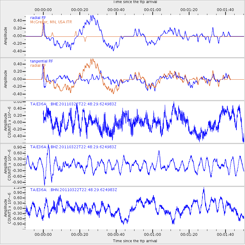
E36A McGregor, MN, USA - Earthquake Result Viewer
*The percent match for this event was below the threshold and hence no stack was calculated.
| Earthquake location: |
Eastern Honshu, Japan |
| Earthquake latitude/longitude: |
37.1/140.6 |
| Earthquake time(UTC): |
2011/03/22 (081) 22:36:32 GMT |
| Earthquake Depth: |
16 km |
| Earthquake Magnitude: |
5.5 MB, 5.2 MS, 5.4 MW, 5.2 MW |
| Earthquake Catalog/Contributor: |
WHDF/NEIC |
|
| Network: |
TA USArray Transportable Network (new EarthScope stations) |
| Station: |
E36A McGregor, MN, USA |
| Lat/Lon: |
46.52 N/93.26 W |
| Elevation: |
393 m |
|
| Distance: |
83.8 deg |
| Az: |
34.1 deg |
| Baz: |
319.527 deg |
| Ray Param: |
$rayparam |
*The percent match for this event was below the threshold and hence was not used in the summary stack. |
|
| Radial Match: |
31.155615 % |
| Radial Bump: |
400 |
| Transverse Match: |
42.36573 % |
| Transverse Bump: |
400 |
| SOD ConfigId: |
356183 |
| Insert Time: |
2011-08-19 00:01:21.693 +0000 |
| GWidth: |
2.5 |
| Max Bumps: |
400 |
| Tol: |
0.001 |
|
Signal To Noise
| Channel | StoN | STA | LTA |
| TA:E36A: :BHZ:20110322T22:48:29.624983Z | 2.2593017 | 5.929866E-7 | 2.6246457E-7 |
| TA:E36A: :BHN:20110322T22:48:29.624983Z | 1.3686906 | 3.7262748E-7 | 2.7225107E-7 |
| TA:E36A: :BHE:20110322T22:48:29.624983Z | 1.0944247 | 2.3349814E-7 | 2.1335241E-7 |
| Arrivals |
| Ps | |
| PpPs | |
| PsPs/PpSs | |


