You are here: Home > Network List > TA - USArray Transportable Network (new EarthScope stations) Stations List
> Station C38A Sawbill Landing (USFS), Superior Nat. Forest, MN, > Earthquake Result Viewer
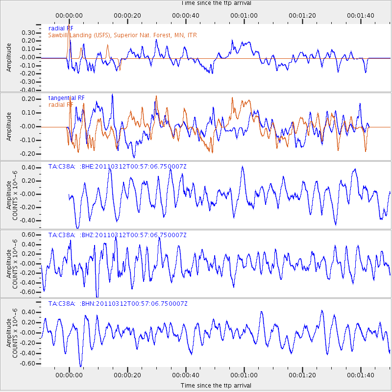
C38A Sawbill Landing (USFS), Superior Nat. Forest, MN, - Earthquake Result Viewer
*The percent match for this event was below the threshold and hence no stack was calculated.
| Earthquake location: |
Near East Coast Of Honshu, Japan |
| Earthquake latitude/longitude: |
36.1/141.8 |
| Earthquake time(UTC): |
2011/03/12 (071) 00:45:09 GMT |
| Earthquake Depth: |
20 km |
| Earthquake Magnitude: |
5.5 MB, 5.1 MS |
| Earthquake Catalog/Contributor: |
WHDF/NEIC |
|
| Network: |
TA USArray Transportable Network (new EarthScope stations) |
| Station: |
C38A Sawbill Landing (USFS), Superior Nat. Forest, MN, |
| Lat/Lon: |
47.72 N/91.27 W |
| Elevation: |
498 m |
|
| Distance: |
84.0 deg |
| Az: |
32.856 deg |
| Baz: |
319.415 deg |
| Ray Param: |
$rayparam |
*The percent match for this event was below the threshold and hence was not used in the summary stack. |
|
| Radial Match: |
53.35098 % |
| Radial Bump: |
400 |
| Transverse Match: |
50.53636 % |
| Transverse Bump: |
400 |
| SOD ConfigId: |
356183 |
| Insert Time: |
2011-08-19 01:03:49.695 +0000 |
| GWidth: |
2.5 |
| Max Bumps: |
400 |
| Tol: |
0.001 |
|
Signal To Noise
| Channel | StoN | STA | LTA |
| TA:C38A: :BHZ:20110312T00:57:06.750007Z | 0.8328727 | 2.056531E-7 | 2.469202E-7 |
| TA:C38A: :BHN:20110312T00:57:06.750007Z | 2.2648396 | 3.0224814E-7 | 1.3345235E-7 |
| TA:C38A: :BHE:20110312T00:57:06.750007Z | 1.0751227 | 2.2146635E-7 | 2.059917E-7 |
| Arrivals |
| Ps | |
| PpPs | |
| PsPs/PpSs | |


