You are here: Home > Network List > CI - Caltech Regional Seismic Network Stations List
> Station LGU LGU, Camarillo, CA, USA > Earthquake Result Viewer
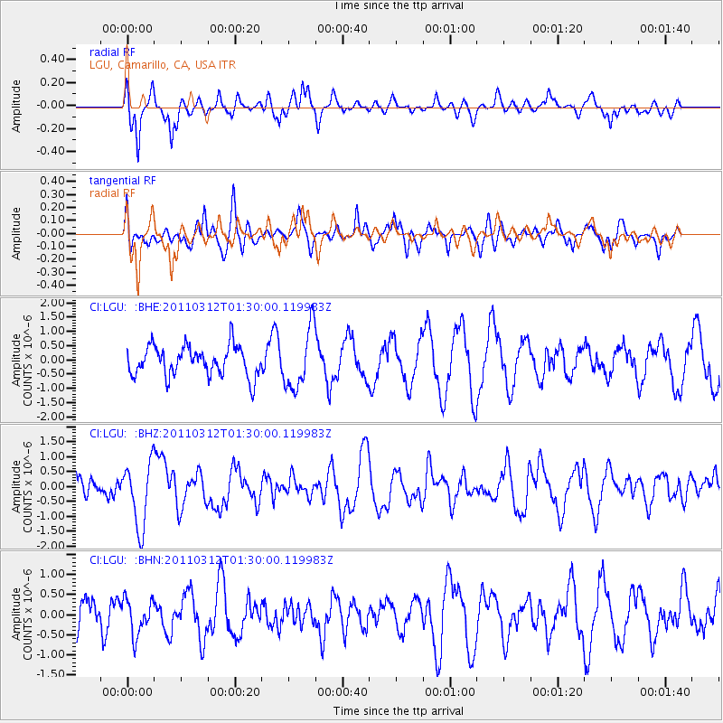
LGU LGU, Camarillo, CA, USA - Earthquake Result Viewer
*The percent match for this event was below the threshold and hence no stack was calculated.
| Earthquake location: |
Tonga Islands |
| Earthquake latitude/longitude: |
-16.7/-173.2 |
| Earthquake time(UTC): |
2011/03/12 (071) 01:19:07 GMT |
| Earthquake Depth: |
14 km |
| Earthquake Magnitude: |
5.7 MB, 6.0 MS, 5.8 MW |
| Earthquake Catalog/Contributor: |
WHDF/NEIC |
|
| Network: |
CI Caltech Regional Seismic Network |
| Station: |
LGU LGU, Camarillo, CA, USA |
| Lat/Lon: |
34.11 N/119.07 W |
| Elevation: |
416 m |
|
| Distance: |
72.2 deg |
| Az: |
44.939 deg |
| Baz: |
234.662 deg |
| Ray Param: |
$rayparam |
*The percent match for this event was below the threshold and hence was not used in the summary stack. |
|
| Radial Match: |
61.535957 % |
| Radial Bump: |
343 |
| Transverse Match: |
64.91639 % |
| Transverse Bump: |
400 |
| SOD ConfigId: |
356183 |
| Insert Time: |
2011-08-19 01:32:20.109 +0000 |
| GWidth: |
2.5 |
| Max Bumps: |
400 |
| Tol: |
0.001 |
|
Signal To Noise
| Channel | StoN | STA | LTA |
| CI:LGU: :BHZ:20110312T01:30:00.119983Z | 2.7377849 | 1.0893654E-6 | 3.9790027E-7 |
| CI:LGU: :BHN:20110312T01:30:00.119983Z | 1.310593 | 4.4369682E-7 | 3.385466E-7 |
| CI:LGU: :BHE:20110312T01:30:00.119983Z | 2.044637 | 1.0622026E-6 | 5.1950667E-7 |
| Arrivals |
| Ps | |
| PpPs | |
| PsPs/PpSs | |


