You are here: Home > Network List > IC - New China Digital Seismograph Network Stations List
> Station ENH Enshi, Hubei Province, China > Earthquake Result Viewer
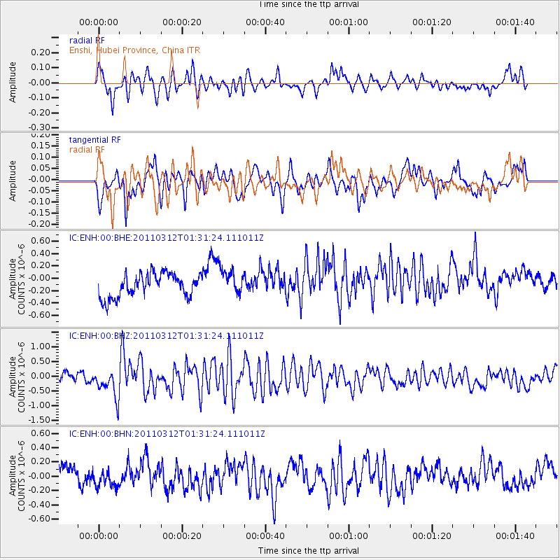
ENH Enshi, Hubei Province, China - Earthquake Result Viewer
*The percent match for this event was below the threshold and hence no stack was calculated.
| Earthquake location: |
Tonga Islands |
| Earthquake latitude/longitude: |
-16.7/-173.2 |
| Earthquake time(UTC): |
2011/03/12 (071) 01:19:07 GMT |
| Earthquake Depth: |
14 km |
| Earthquake Magnitude: |
5.7 MB, 6.0 MS, 5.8 MW |
| Earthquake Catalog/Contributor: |
WHDF/NEIC |
|
| Network: |
IC New China Digital Seismograph Network |
| Station: |
ENH Enshi, Hubei Province, China |
| Lat/Lon: |
30.28 N/109.49 E |
| Elevation: |
500 m |
|
| Distance: |
87.8 deg |
| Az: |
302.377 deg |
| Baz: |
110.692 deg |
| Ray Param: |
$rayparam |
*The percent match for this event was below the threshold and hence was not used in the summary stack. |
|
| Radial Match: |
69.62228 % |
| Radial Bump: |
400 |
| Transverse Match: |
64.24031 % |
| Transverse Bump: |
400 |
| SOD ConfigId: |
356183 |
| Insert Time: |
2011-08-19 01:38:41.371 +0000 |
| GWidth: |
2.5 |
| Max Bumps: |
400 |
| Tol: |
0.001 |
|
Signal To Noise
| Channel | StoN | STA | LTA |
| IC:ENH:00:BHZ:20110312T01:31:24.111011Z | 3.1202922 | 5.902338E-7 | 1.8915979E-7 |
| IC:ENH:00:BHN:20110312T01:31:24.111011Z | 0.54576784 | 9.235281E-8 | 1.692163E-7 |
| IC:ENH:00:BHE:20110312T01:31:24.111011Z | 1.015811 | 1.9132014E-7 | 1.8834227E-7 |
| Arrivals |
| Ps | |
| PpPs | |
| PsPs/PpSs | |


