You are here: Home > Network List > IW - Intermountain West Stations List
> Station MOOW Moose Ponds, Wyoming, USA > Earthquake Result Viewer
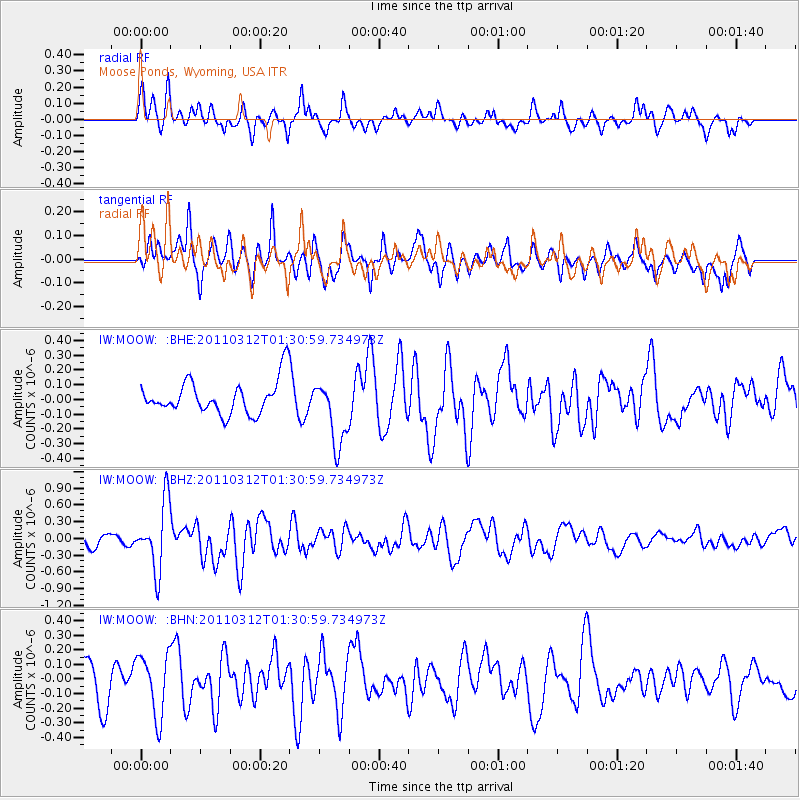
MOOW Moose Ponds, Wyoming, USA - Earthquake Result Viewer
*The percent match for this event was below the threshold and hence no stack was calculated.
| Earthquake location: |
Tonga Islands |
| Earthquake latitude/longitude: |
-16.7/-173.2 |
| Earthquake time(UTC): |
2011/03/12 (071) 01:19:07 GMT |
| Earthquake Depth: |
14 km |
| Earthquake Magnitude: |
5.7 MB, 6.0 MS, 5.8 MW |
| Earthquake Catalog/Contributor: |
WHDF/NEIC |
|
| Network: |
IW Intermountain West |
| Station: |
MOOW Moose Ponds, Wyoming, USA |
| Lat/Lon: |
43.75 N/110.74 W |
| Elevation: |
2128 m |
|
| Distance: |
82.9 deg |
| Az: |
40.359 deg |
| Baz: |
238.9 deg |
| Ray Param: |
$rayparam |
*The percent match for this event was below the threshold and hence was not used in the summary stack. |
|
| Radial Match: |
48.26728 % |
| Radial Bump: |
384 |
| Transverse Match: |
58.25948 % |
| Transverse Bump: |
365 |
| SOD ConfigId: |
356183 |
| Insert Time: |
2011-08-19 01:44:16.958 +0000 |
| GWidth: |
2.5 |
| Max Bumps: |
400 |
| Tol: |
0.001 |
|
Signal To Noise
| Channel | StoN | STA | LTA |
| IW:MOOW: :BHZ:20110312T01:30:59.734973Z | 5.0503817 | 6.033037E-7 | 1.1945704E-7 |
| IW:MOOW: :BHN:20110312T01:30:59.734973Z | 1.3262737 | 2.095796E-7 | 1.5802138E-7 |
| IW:MOOW: :BHE:20110312T01:30:59.734973Z | 1.9667218 | 2.2483668E-7 | 1.14320535E-7 |
| Arrivals |
| Ps | |
| PpPs | |
| PsPs/PpSs | |


