You are here: Home > Network List > IW - Intermountain West Stations List
> Station DLMT Dillon, Montana, USA > Earthquake Result Viewer
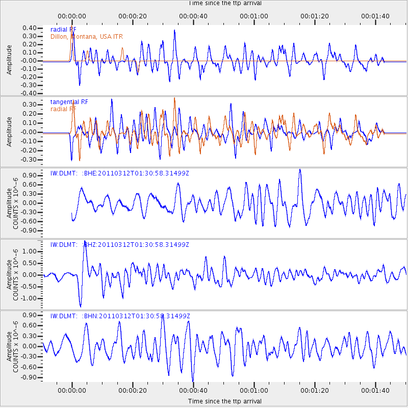
DLMT Dillon, Montana, USA - Earthquake Result Viewer
*The percent match for this event was below the threshold and hence no stack was calculated.
| Earthquake location: |
Tonga Islands |
| Earthquake latitude/longitude: |
-16.7/-173.2 |
| Earthquake time(UTC): |
2011/03/12 (071) 01:19:07 GMT |
| Earthquake Depth: |
14 km |
| Earthquake Magnitude: |
5.7 MB, 6.0 MS, 5.8 MW |
| Earthquake Catalog/Contributor: |
WHDF/NEIC |
|
| Network: |
IW Intermountain West |
| Station: |
DLMT Dillon, Montana, USA |
| Lat/Lon: |
45.36 N/112.60 W |
| Elevation: |
1569 m |
|
| Distance: |
82.6 deg |
| Az: |
38.273 deg |
| Baz: |
237.341 deg |
| Ray Param: |
$rayparam |
*The percent match for this event was below the threshold and hence was not used in the summary stack. |
|
| Radial Match: |
58.17389 % |
| Radial Bump: |
316 |
| Transverse Match: |
65.60068 % |
| Transverse Bump: |
363 |
| SOD ConfigId: |
356183 |
| Insert Time: |
2011-08-19 01:46:24.754 +0000 |
| GWidth: |
2.5 |
| Max Bumps: |
400 |
| Tol: |
0.001 |
|
Signal To Noise
| Channel | StoN | STA | LTA |
| IW:DLMT: :BHZ:20110312T01:30:58.31499Z | 5.0680447 | 7.3631634E-7 | 1.4528608E-7 |
| IW:DLMT: :BHN:20110312T01:30:58.31499Z | 1.981264 | 3.422078E-7 | 1.7272197E-7 |
| IW:DLMT: :BHE:20110312T01:30:58.31499Z | 1.0062388 | 2.4685866E-7 | 2.453281E-7 |
| Arrivals |
| Ps | |
| PpPs | |
| PsPs/PpSs | |


