You are here: Home > Network List > KN - Kyrgyz Seismic Telemetry Network Stations List
> Station ULHL - > Earthquake Result Viewer
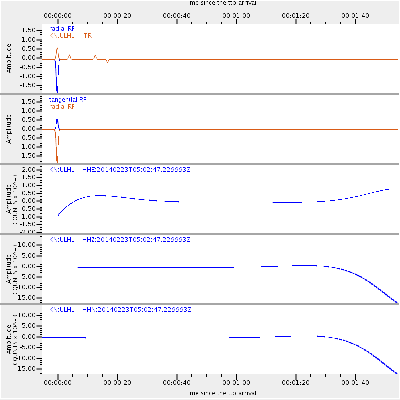
ULHL - - Earthquake Result Viewer
*The percent match for this event was below the threshold and hence no stack was calculated.
| Earthquake location: |
Kuril Islands |
| Earthquake latitude/longitude: |
43.5/147.8 |
| Earthquake time(UTC): |
2014/02/23 (054) 04:54:18 GMT |
| Earthquake Depth: |
20 km |
| Earthquake Magnitude: |
5.5 MWC, 5.3 MWB, 5.5 MWC |
| Earthquake Catalog/Contributor: |
NEIC PDE/NEIC COMCAT |
|
| Network: |
KN Kyrgyz Seismic Telemetry Network |
| Station: |
ULHL - |
| Lat/Lon: |
42.25 N/76.24 E |
| Elevation: |
2040 m |
|
| Distance: |
50.9 deg |
| Az: |
294.837 deg |
| Baz: |
62.777 deg |
| Ray Param: |
$rayparam |
*The percent match for this event was below the threshold and hence was not used in the summary stack. |
|
| Radial Match: |
99.99999 % |
| Radial Bump: |
2 |
| Transverse Match: |
99.99999 % |
| Transverse Bump: |
2 |
| SOD ConfigId: |
3390531 |
| Insert Time: |
2019-04-10 10:22:49.822 +0000 |
| GWidth: |
2.5 |
| Max Bumps: |
400 |
| Tol: |
0.001 |
|
Signal To Noise
| Channel | StoN | STA | LTA |
| KN:ULHL: :HHZ:20140223T05:02:47.229993Z | 0.26778874 | 8.2846476E-5 | 3.0937252E-4 |
| KN:ULHL: :HHN:20140223T05:02:47.229993Z | 0.26797047 | 8.304769E-5 | 3.099136E-4 |
| KN:ULHL: :HHE:20140223T05:02:47.229993Z | 0.2678335 | 8.2569386E-5 | 3.0828628E-4 |
| Arrivals |
| Ps | |
| PpPs | |
| PsPs/PpSs | |


