You are here: Home > Network List > TA - USArray Transportable Network (new EarthScope stations) Stations List
> Station Y38A Idabel, OK, USA > Earthquake Result Viewer
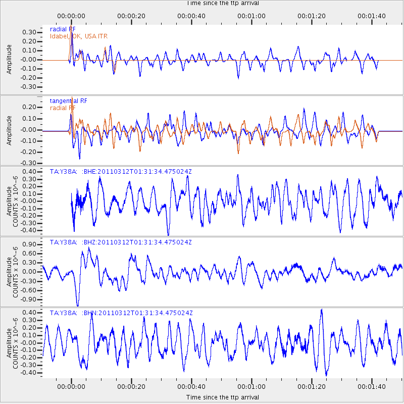
Y38A Idabel, OK, USA - Earthquake Result Viewer
*The percent match for this event was below the threshold and hence no stack was calculated.
| Earthquake location: |
Tonga Islands |
| Earthquake latitude/longitude: |
-16.7/-173.2 |
| Earthquake time(UTC): |
2011/03/12 (071) 01:19:07 GMT |
| Earthquake Depth: |
14 km |
| Earthquake Magnitude: |
5.7 MB, 6.0 MS, 5.8 MW |
| Earthquake Catalog/Contributor: |
WHDF/NEIC |
|
| Network: |
TA USArray Transportable Network (new EarthScope stations) |
| Station: |
Y38A Idabel, OK, USA |
| Lat/Lon: |
33.93 N/94.73 W |
| Elevation: |
118 m |
|
| Distance: |
90.0 deg |
| Az: |
54.558 deg |
| Baz: |
249.869 deg |
| Ray Param: |
$rayparam |
*The percent match for this event was below the threshold and hence was not used in the summary stack. |
|
| Radial Match: |
56.843887 % |
| Radial Bump: |
400 |
| Transverse Match: |
52.249096 % |
| Transverse Bump: |
373 |
| SOD ConfigId: |
356183 |
| Insert Time: |
2011-08-19 02:33:23.641 +0000 |
| GWidth: |
2.5 |
| Max Bumps: |
400 |
| Tol: |
0.001 |
|
Signal To Noise
| Channel | StoN | STA | LTA |
| TA:Y38A: :BHZ:20110312T01:31:34.475024Z | 3.5242813 | 5.22725E-7 | 1.4832102E-7 |
| TA:Y38A: :BHN:20110312T01:31:34.475024Z | 1.2803296 | 1.8849445E-7 | 1.4722337E-7 |
| TA:Y38A: :BHE:20110312T01:31:34.475024Z | 1.4507543 | 2.1279237E-7 | 1.4667705E-7 |
| Arrivals |
| Ps | |
| PpPs | |
| PsPs/PpSs | |


