You are here: Home > Network List > TA - USArray Transportable Network (new EarthScope stations) Stations List
> Station O03D Paynes Creek, CA, USA > Earthquake Result Viewer
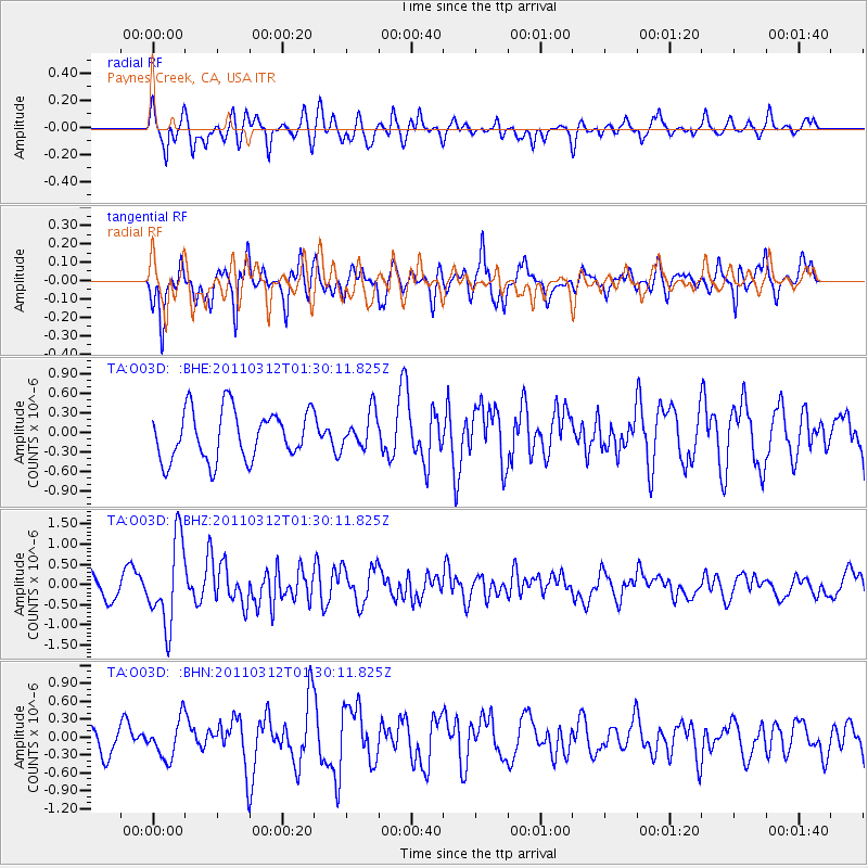
O03D Paynes Creek, CA, USA - Earthquake Result Viewer
*The percent match for this event was below the threshold and hence no stack was calculated.
| Earthquake location: |
Tonga Islands |
| Earthquake latitude/longitude: |
-16.7/-173.2 |
| Earthquake time(UTC): |
2011/03/12 (071) 01:19:07 GMT |
| Earthquake Depth: |
14 km |
| Earthquake Magnitude: |
5.7 MB, 6.0 MS, 5.8 MW |
| Earthquake Catalog/Contributor: |
WHDF/NEIC |
|
| Network: |
TA USArray Transportable Network (new EarthScope stations) |
| Station: |
O03D Paynes Creek, CA, USA |
| Lat/Lon: |
40.29 N/121.80 W |
| Elevation: |
968 m |
|
| Distance: |
74.2 deg |
| Az: |
38.417 deg |
| Baz: |
231.122 deg |
| Ray Param: |
$rayparam |
*The percent match for this event was below the threshold and hence was not used in the summary stack. |
|
| Radial Match: |
65.31731 % |
| Radial Bump: |
327 |
| Transverse Match: |
77.28427 % |
| Transverse Bump: |
358 |
| SOD ConfigId: |
356183 |
| Insert Time: |
2011-08-19 02:39:53.938 +0000 |
| GWidth: |
2.5 |
| Max Bumps: |
400 |
| Tol: |
0.001 |
|
Signal To Noise
| Channel | StoN | STA | LTA |
| TA:O03D: :BHZ:20110312T01:30:11.825Z | 3.2349348 | 1.0470451E-6 | 3.2366808E-7 |
| TA:O03D: :BHN:20110312T01:30:11.825Z | 1.3587021 | 3.160371E-7 | 2.326022E-7 |
| TA:O03D: :BHE:20110312T01:30:11.825Z | 0.73200005 | 2.7791623E-7 | 3.7966694E-7 |
| Arrivals |
| Ps | |
| PpPs | |
| PsPs/PpSs | |


