You are here: Home > Network List > TA - USArray Transportable Network (new EarthScope stations) Stations List
> Station Y40A Okolona, AR, USA > Earthquake Result Viewer
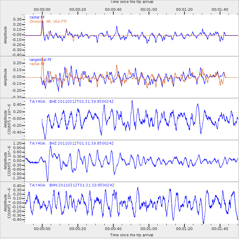
Y40A Okolona, AR, USA - Earthquake Result Viewer
*The percent match for this event was below the threshold and hence no stack was calculated.
| Earthquake location: |
Tonga Islands |
| Earthquake latitude/longitude: |
-16.7/-173.2 |
| Earthquake time(UTC): |
2011/03/12 (071) 01:19:07 GMT |
| Earthquake Depth: |
14 km |
| Earthquake Magnitude: |
5.7 MB, 6.0 MS, 5.8 MW |
| Earthquake Catalog/Contributor: |
WHDF/NEIC |
|
| Network: |
TA USArray Transportable Network (new EarthScope stations) |
| Station: |
Y40A Okolona, AR, USA |
| Lat/Lon: |
34.01 N/93.28 W |
| Elevation: |
117 m |
|
| Distance: |
91.1 deg |
| Az: |
54.886 deg |
| Baz: |
250.673 deg |
| Ray Param: |
$rayparam |
*The percent match for this event was below the threshold and hence was not used in the summary stack. |
|
| Radial Match: |
66.02542 % |
| Radial Bump: |
400 |
| Transverse Match: |
56.93838 % |
| Transverse Bump: |
389 |
| SOD ConfigId: |
356183 |
| Insert Time: |
2011-08-19 02:53:57.286 +0000 |
| GWidth: |
2.5 |
| Max Bumps: |
400 |
| Tol: |
0.001 |
|
Signal To Noise
| Channel | StoN | STA | LTA |
| TA:Y40A: :BHZ:20110312T01:31:39.850024Z | 4.753778 | 6.4225884E-7 | 1.3510493E-7 |
| TA:Y40A: :BHN:20110312T01:31:39.850024Z | 0.57018197 | 8.9166235E-8 | 1.5638206E-7 |
| TA:Y40A: :BHE:20110312T01:31:39.850024Z | 1.2210047 | 2.2568489E-7 | 1.8483539E-7 |
| Arrivals |
| Ps | |
| PpPs | |
| PsPs/PpSs | |


